Southeast Pacific Cruise - April-May 2014
MV Marina - Oceania Cruise Lines
Observations about the ship:
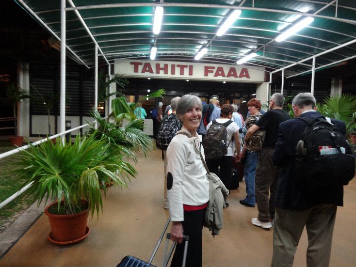
Oceania provides transfers from the airport to the ship but are extremely overpriced. The 7 mile trip from Papeete Faa'a airport was $129 per person. I contracted directly with a company called I Hate Taxis for $79 for the two of us. Guess what? We were on the same bus as those who paid the $129pp tariff!
We had a Concierge Level Verandah stateroom on Deck 9. The room was roomy enough for the two of us. They advertise that these staterooms each have a PC for your use. The PCs are locked, no access to the drives, the USB ports, etc. They are set up simply as a terminal for their wireless internet service and have Microsoft Word that you can use to prepare notes for youe email. We fortunately brought along a laptop so that we could download our pictures and videos and process photos for email to family and friends. I had an on-going business transaction and I had forms emailed to me that I had to complete and sign and return. I took the PDF file to the Computer Center where the administrator printed the pages for me. After I completed the forms, I took them to the Reception Desk and they emailed them for me for $4.95. I copied myself on the email and the pages were transmitted promptly.
All the staff is very friendly and helpful. Most nationalities are represented, many Eastern Europeans as well as the usual Filipino and Indonesian.
Food was not exceptional contrary to their claim to fame! About on a par with HAL in that they had a good selection of entrees. Other passengers have stated the same. Best for me was the Filet au Poivre in Jacques specialty restaurant. The meat was thick, cooked right, but sauce was not as peppery as I like. Marilyn's favorite was the grilled Norwegian
salmon in the Grand Dining Room. Breakfasts were good wherever we ate. Waves on Deck 12 had the best hamburgers we've ever had on a
ship. The meat was loose (fresh) whereas on HAL they are hard compressed frozen patties. We ate in 3 of the specialty restaurants (Jacques, Toscana, and Polo). There is no charge to dine there unlike HAL. We did not like Toscana, the food was almost poor. The other two were fine but certainly not exceptional.
The TV movies were horrible, four channels only and the selections stunk! The DVD collection was great and were free.
They have an extensive library. You can take books anytime of the day and night. The books are categorized into 10 or 12 types so items are interest are easily located.
The music channel 29 was labeled Country. It was soft jazz. Checked all the other music channels and none had anything remotely country.
Cash advances were easy but they charge a 5% fee.
The laundromat was good - one on each passenger deck. $2 to wash a $2 to dry a load.
The excursions are grossly overpriced, at least 2 to 3 times what you can buy yourself. Their allocation of tender tickets absolutely sucks. You had to go to the Marina lounge on Deck 5. If you had ship's excursions you were immediately given seats and given tender tickets to make their scheduled departure. Those of us with our own tours (independents) were assigned a few rows of seats and the rest of us had to stand in a line for as long as 2 hours before we got a seat, bear in mind that the vast majority of passengers are 60+ years old. The ship's tours had priority whereas the independents had to wait until the ship's tours were disembarked. We were
almost 3 hours late for our tour on the first day at Easter Island. To put it into perspective, Azamara tours were priced about 2 times the actual cost but they allow you to get a 50% discount on all their tours as long as you commit prior to sailing. With this discount, the prices were fair and we used ship's tours on every day in port on the Azamara cruise.
One of the reasons we picked this cruise was because it was advertising a landing on Pitcairn
Island, the island where the Bounty mutineers settled. Up to the night before, we were led to believe we would be able to go ashore, they even provided walking trail maps of the island. The next morning they announced that we were not going to land and that the islanders were aboard setting up shop to sell souveniers! The single engine motor whale boat they used to come to
the ship was open and carried 42 people to the ship. They could make it out and back but the ship's tenders that have dual engines and props could not (the tenders are enclosed and can carry around 100 or more passengers.). Jaqui Christian, an islander, gave a presentation onbard. Someone asked how many people make it ashore. She said that season they had fourteen cruise ships anchor and only 80 people actually got ashore (equating to probably about 1%). IMHO, it is criminal to advertise this when they know 99% of the time they do not land!
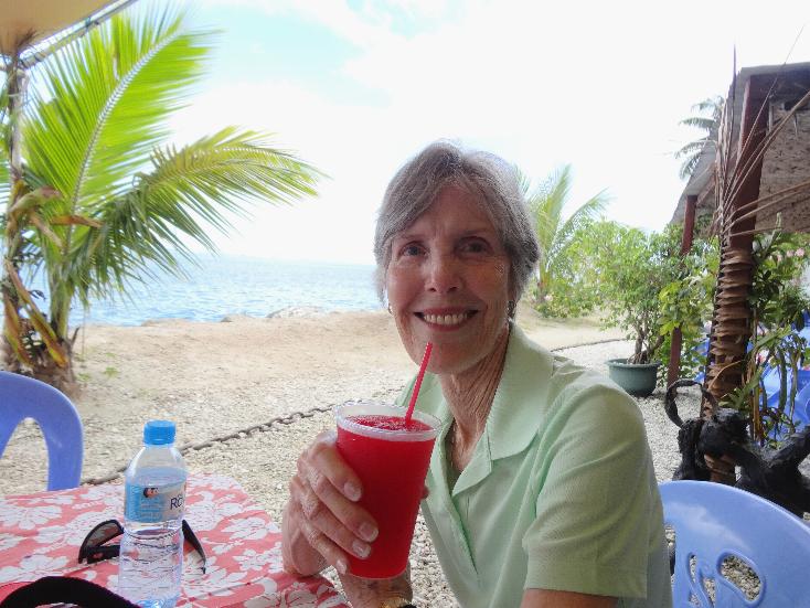
They have Happy Hour in three of the bars daily from 1700-1800, two for one drinks. I usually drink Groelsch Beer with is $7.50 a bottle plus 18% gratuity. At Happy Hour, they were half price. I finally figured out - buy your daily beer supply at Happy Hour and keep them in your stateroom refrigerator.
Bottom line - Oceania is very good due to the ports they service with the sole
exception of Pitcairn Island. Their claims to outstanding food is vastly overstated. Their staff is capable and friendly. Their tours are way overpriced.
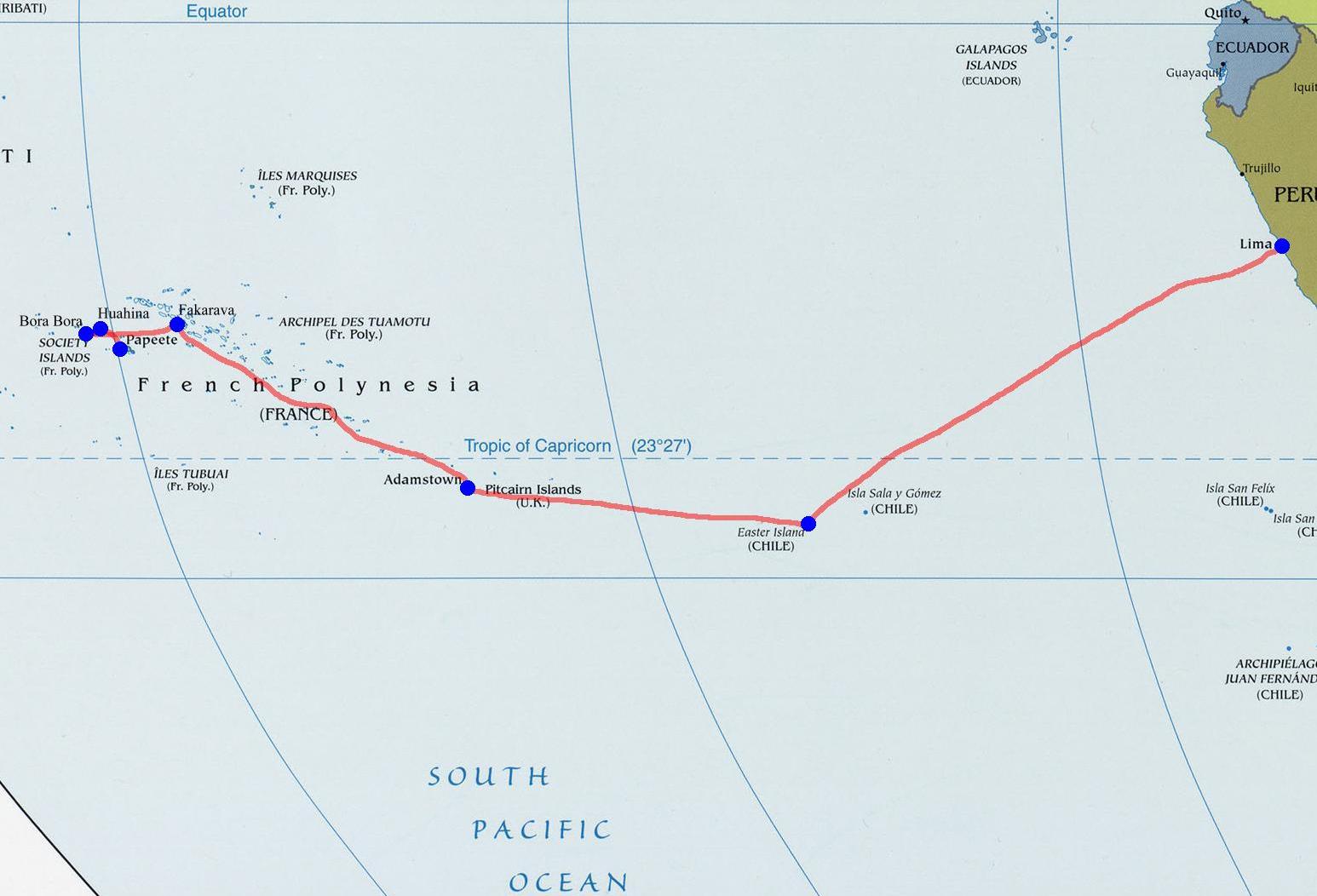
Itinerary
Courtesy of www.worldofmaps.net
| 19 April 2014 | Papeete, Tahiti |
| 20 April 2014 | Huaine, Socirty Islands |
| 21-22 April 2014 | Bora Bora, Society Islands |
| 23 April 2014 | At Sea |
| 24 April 2014 | Fakarava, Tuamotu Islands |
| 25-26 April 2014 | Ar Sea |
| 27 April 2014 | Pitcairn Island |
| 28-29 April 2014 | At Sea |
| 30 April - 1 May 2014 | Easter Island |
| 2 - 5 May 2014 | At Sea |
| 6 May 2014 | Callao, Peru |
| 6-8 May 2014 | Lima Peru |
We flew from Atlanta to Papeete by way of Los Angeles.
We arrived in Papeete at 1930 local time and proceeded immediately to the ship which was to depart Papeete at 2300 hours. The cruise terminated in Callao, Peru. We spent another two days in Lima staying at the Sheraton Hotel on Plaza del Armas.
Much of the background information included here has been garnered from various internet sources, mostly Wikipedia.
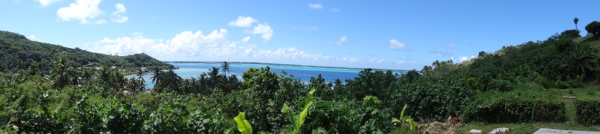
FRENCH POLYNESIA
Papeete, Tahiti
BACKGROUND:
Tahiti is the largest island in the Îles sous du Vent of French Polynesia (an overseas country of the French Republic), located in the archipelago of the Society Islands in the southern Pacific Ocean. It is the economic, cultural and political center of French Polynesia. The island was formed from volcanic activity and is high and mountainous with surrounding coral reefs.
The capital, Papeete, is located on the northwest coast. Tahiti was originally settled by Polynesians between 300 and 800 AD. They comprise about 70% of the island's population with the rest made up of Europeans, Chinese and those of mixed heritage. The island was proclaimed a colony of France in 1880 although it was not until 1946 that the indigenous Tahitians were legally authorized to be French citizens. French is the only official language although the Tahitian language (Reo Maohi) is widely spoken. It was part of the Kingdom of Tahiti until its annexation by France in 1880.
OUR VISIT:
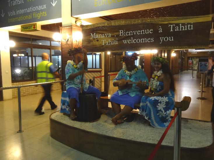
We flew from Atlanta to Los Angeles on Delta. At LAX we had a $40+ lunch: hamburger, draft beer, yoghurt, and a soda. Our Air Tahiti Nui flight departed LAX at 1400. We arrived in Papeete at 1900. We had a shuttle to the ship (costing us $79 on the same service that the ship wanted $258 to carry us on the same company). We were unable to sleep on the plane so we were bushed when we got to our stateroom. The ship's TV said we would have the safety drill prior to departure at 2300. We finally were fading by 2100 so I called the reception to confirm they were having it that night. They said that would be at 0815 the next morning, so we retired for the night.
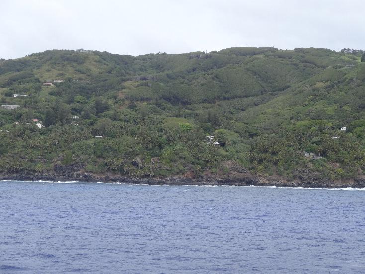
In the morning we arrived at Huahine Island.
Huahine
BACKGROUND:
Huahine is an island located among the Society Islands, in French Polynesia, an overseas territory of France in the Pacific Ocean. It is part of the Leeward Islands group (Îles sous le Vent). The island has a population of about 6,000. Huahine measures about 10iles in length, with a maximum width of of abo0ut 8 miles. It is made up of two main islands surrounded by a fringing coral reef with several motu (small islands). Huahine Nui (Big Huahine) lies to the north and Huahine Iti (Little Huahine) to the south. The two islands are separated by a few hundred yards of water and joined by a sandspit at low tide. A small bridge was built to connect Huahine Nui and Huahine Iti. In the northwest of Huahine Nui lies a 925 acre brackish lake known as Lac Fauna Nui (Lac Maeva). This lake is all that remains of the ancient atoll lagoon.
OUR VISIT:
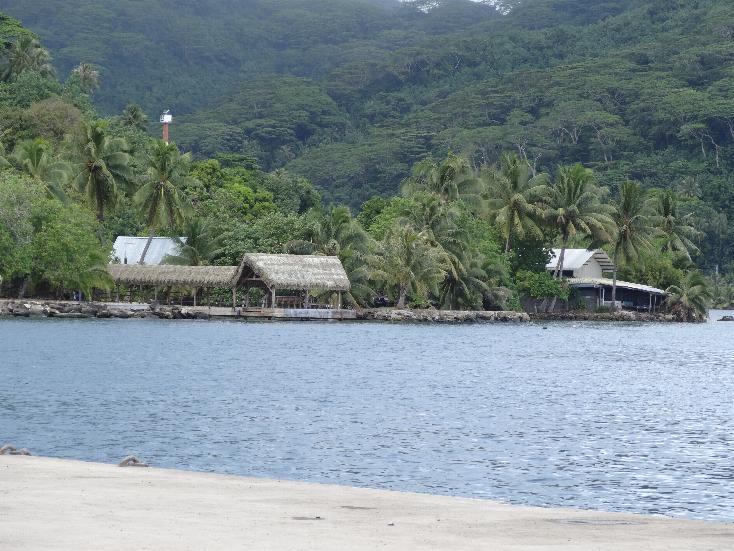
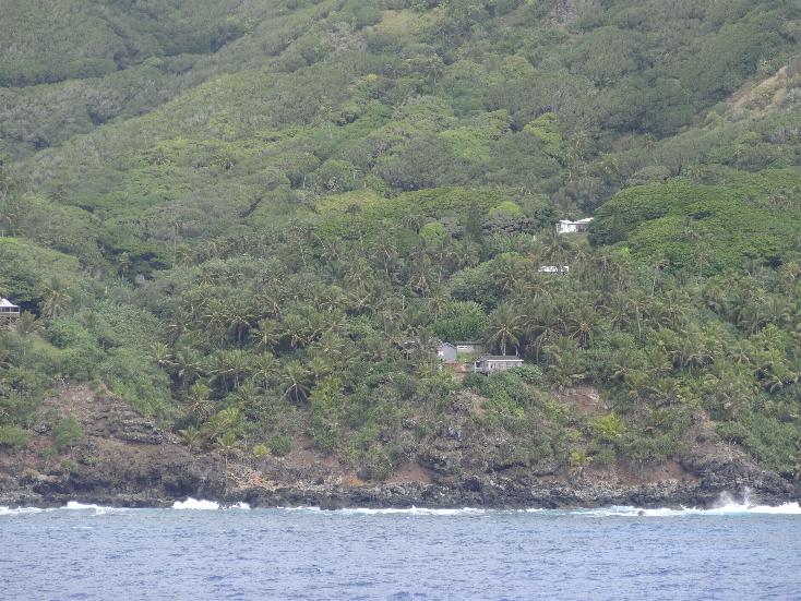
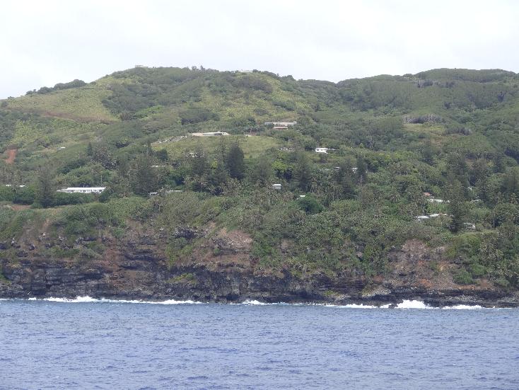
What a genuine South Pacific paradise! Mostly jungle with coconut palms and a few small villages. The island is mountainous and the main feature is a mountain whose Tahitian name means pregnent woman. The mountain looks like a pregnant lady lying on her back. The locals enjoy a great place to live and obviously enjoy the tourists that visit their island. We had hoped to attend Easter Mass ashore at 0900 but the ship's safety drill and method of allocating tender seats ruined any chance of that.
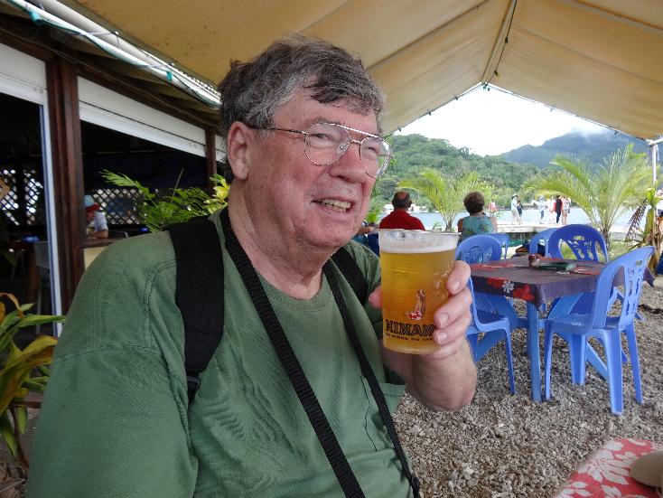
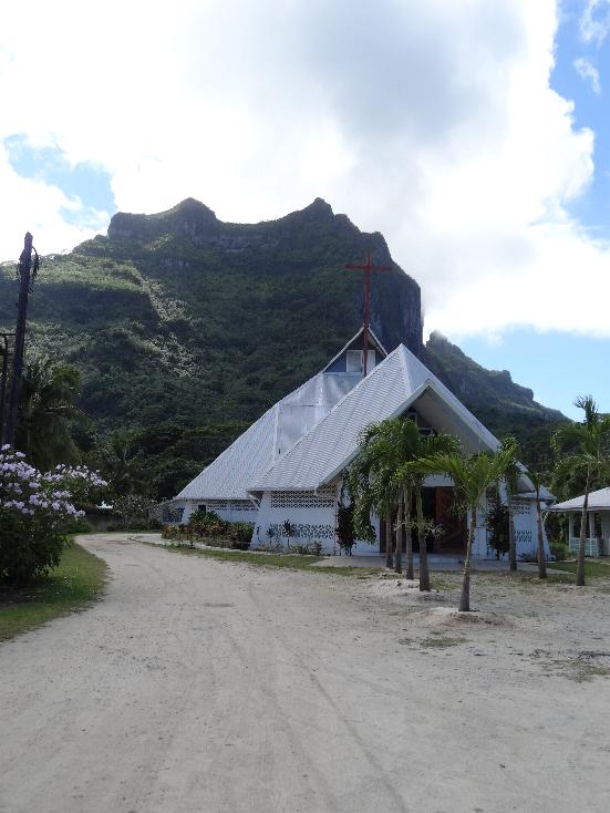
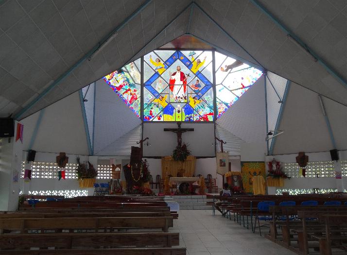
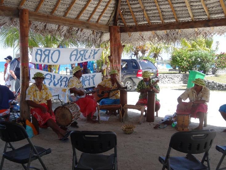
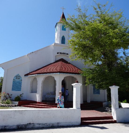
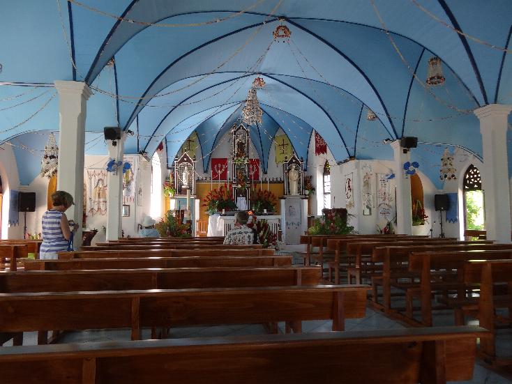
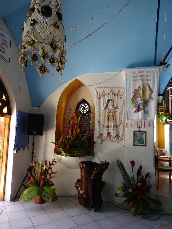
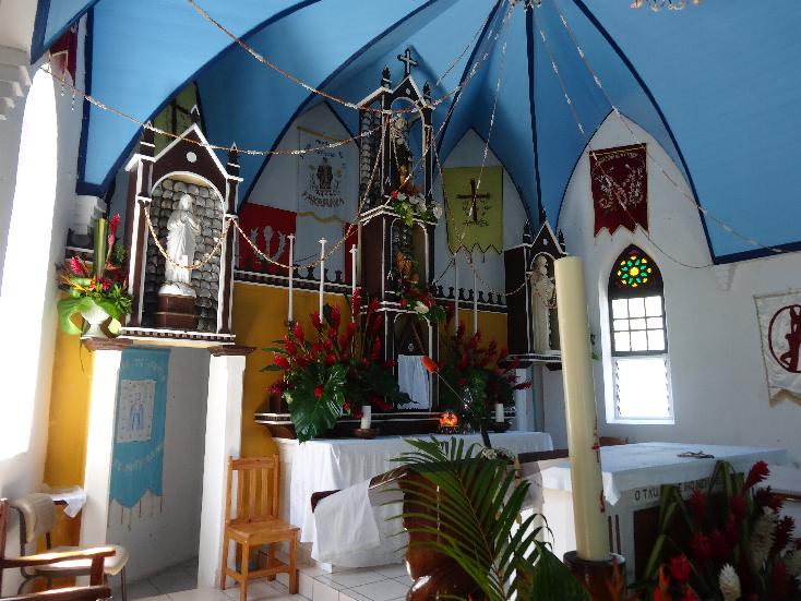
We finally got ashore around 0930. There were three local fellows on the landing playing ukeleles and singing Tahitian songs. We boarded a bus to go to Fare, the largest village on the island. On the way we got to see a lot of the countryside and their homes spread through the area. When we got there we walked up to the church but Mass was over. We made a short visit and took some photos inside this uniquely decorated church. After that we walked into town where we visited a few shops. We finally stopped at the supermarket to buy a few things including a couple of bottles of the local brew, Hinano. Great beer! We then walked to a bar on the beach where Marilyn enjoyed a strawberry punch that was delicious and I "suffered" through a glass of Hinano (actually a very good brew). We watched a couple of local youngsters fish and a sweet young thing who came up to the dock in a motorboat carrying a surfboard when she disembarked. After that we returned to the ship for an excellent lunch.
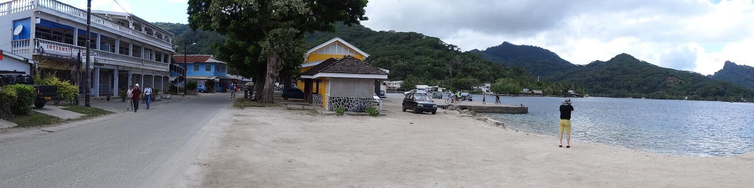
Main street of Fare
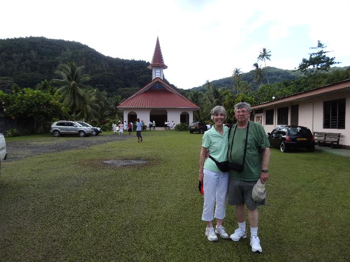
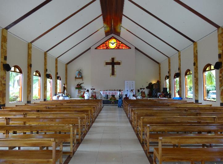
Église Sainte Famille
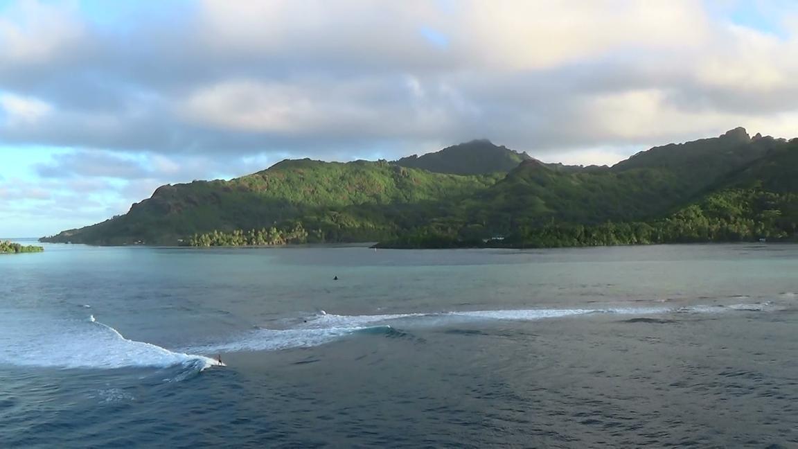
We departed Huahine at 1700 with the locals serenading us from shore. As we steamed out of the lagoon we could see the waves crashing on the reef. There was a group of fellows surfboarding the waves and one had a great long successful run. We was cheered from our shop and he waved in return.
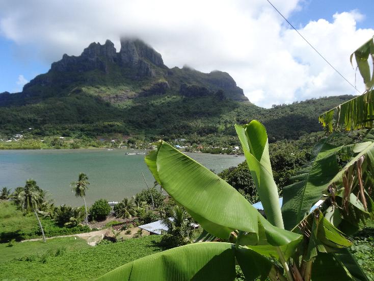
Bora Bora
BACKGROUND:
Bora Bora is an island in the Leeward group (Îles sous le Vent) of the Society Islands of French Polynesia. The island, located about 145 miles northwest of Papeete, is surrounded by a lagoon and a barrier reef. In the centre of the island are the remnants of an extinct volcano rising to two peaks, Mount Pahia and Mount Otemanu, the highest point at 2,385 feet. The major settlement, Vaitape, is on the western side of the main island, opposite the main channel into the lagoon. Produce of the island is mostly limited to what can be obtained from the sea and the plentiful coconut trees, which were historically of economic importance for copra. Bora Bora has a permanent population of 8,880.
The island was first inhabited by Polynesian settlers around the 4th century AD. The first European sighting was made by Jakob Roggeveen in 1722. James Cook sighted the island in 1770 and landed that same year. The London Missionary Society arrived in 1820 and founded a Protestant church in 1890. Bora Bora was an independent kingdom until 1888 when its last queen Teriimaevarua III was forced to abdicate by the French who annexed the island as a colony.
OUR VISIT:
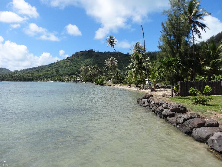
We steamed into the lagoon early in the morning. Bora Bora has several small islands around it. Bora Bora used to be home to several large and famous resorts. At least a quarter of them have shut down since 2008 as a result of the worldwide effect of the Obama depression. A few have been bought by others who plan to reopen them.
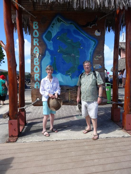
We took a van tour of the island. We saw a lot of pretty scenery, locals' homes, and resorts. Then we returned to Vaitape to just wander around the town.
Vaitape Catholic church
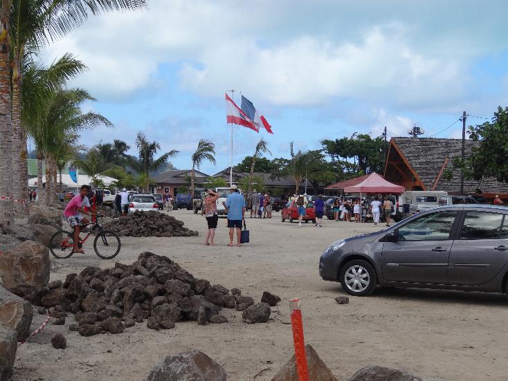
The Landing Vaitape ---- View of Pofai Bay taken from Bloody Mary's\
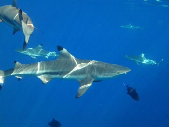
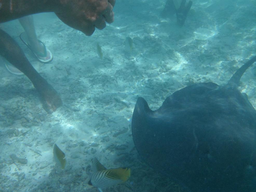
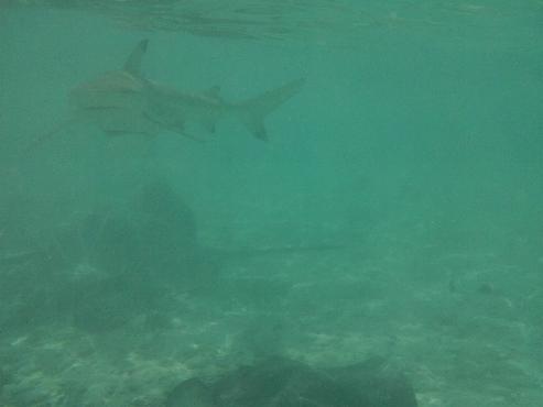
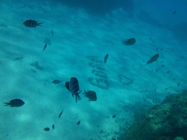
We inquired about getting a glass bottom boat trip the next day. Guess what, the cruise lines had them agree only to carry passengers if they bought the tour through the ship at their prices which are about three times the independent price. We instead joined a tour boat to go around the island. We first stopped for a lemon shark feeding where Marilyn snorkeled while they were feeding. Next we went out near the reef to see rays and the crew caught one and kissed it, he said it was his girlfriend (the stinger is the barb on the bottom of the tail so you simply avoid that part). A friend we met on a similar ride was bitten on two fingers by one and they think it was because he had a large gold ring with a blue stone that the ray probably thought was a fish!
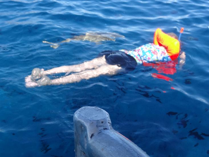
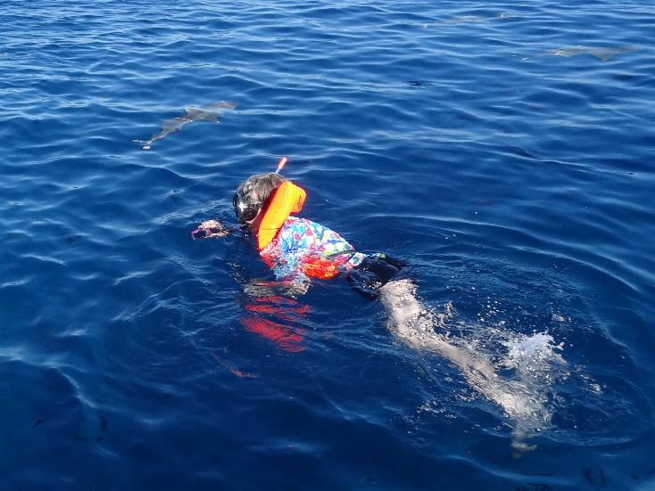
Marilyn swimming with a shark alongside
We bought a cheap SVC underwater camera. It worked great! These are underwater shots taken by Marilyn.
Then we stopped at a private island for a lunch of local fruits. The crew showed us hermit crabs and sea urchins. This trip was most enjoyable. The boat is called the Nuihati and the crew is Adrian, an older fellow, and two young crewmen, Jeff and Mario.
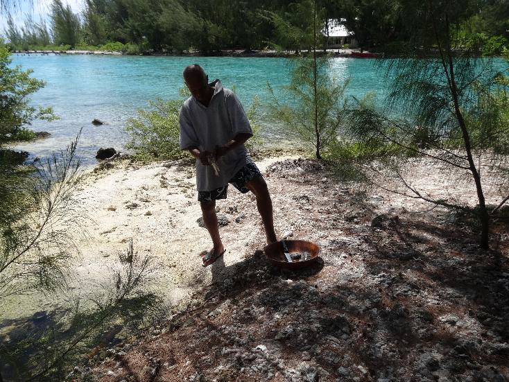
At right, Adrian cleans fish caught by a guest from Hawaii
We departed Bora Bora on Tuesday night around 1900 hours bound for Fakarava.
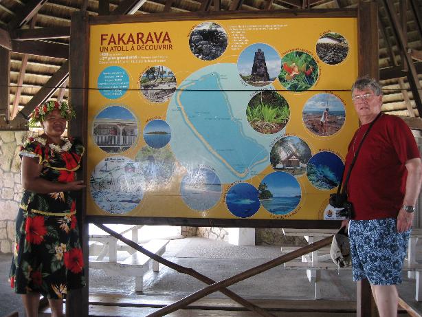
Fakarava
BACKGROUND:
Fakarava, Havaiki-te-araro, Havai'i or Farea is an atoll in the west of the Tuamotu group in French Polynesia. It is the second largest of the Tuamotu atolls. The shape of Fakarava Atoll is roughly rectangular and its length is 37 miles and its width 13 miles. Fakarava has a wide and deep lagoon with a surface of 439 miles² and two passes. The main pass to enter the lagoon, located in its north-western end, is known as Passe Garuae and it is the largest pass in French Polynesia; the southern pass is called Tumakohua (also known as Tetamanu). It has a land area of 6 miles2. Fakarava has 855 inhabitants; the main village is called Rotoava.
The first recorded European to arrive to Fakarava Atoll was Russian oceanic explorer Fabian Gottlieb von Bellingshausen on 17 July 1820 on ships Vostok and Mirni. He named this atoll "Wittgenstein". Fakarava's inhabitants were evangelized by Belgian Jesuit priest Honoré Laval in 1849. The church at Rotoava was dedicated in 1850.
OUR VISIT:
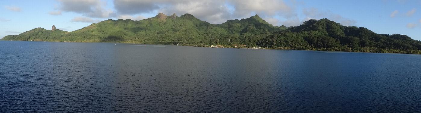
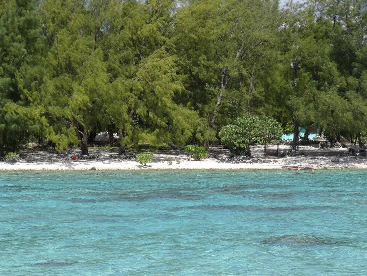
We arrived at Fakarava Atoll at 0800. The atoll is
rectangular in shape about 37 miles long with a very short width of land around
a large lagoon. There are two passages in, one from the north, the other from
the south. The atoll is very low, the highest point probably no more than 10
feet above sea level. There are no hills. The atoll is heavily forested with
coconut palms, banana, and breadfruit trees. The people are largely Catholic but
there is a small Morman congregation.
We took a short van tour of the eastern side of the
atoll. The driver was a Tahitian lass named Julianne (her husband was one of the
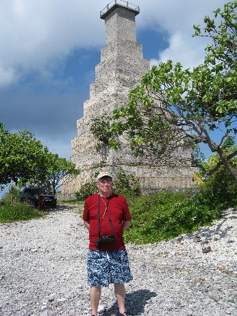
music group at the landing). We first drove north to the airfield then south to
the hotel/resort. We saw the two lighthouses, the larger was built in 1957.
Neither is active now. The high temperature was about 80 F but when we were in
the direct sun, it was pretty brutal.
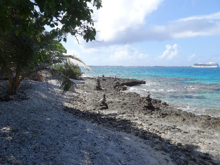
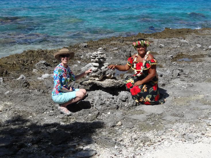
Cairns on the beach --- Marilyn and Julianne
The lighthouses
Fakarava homes
Catholic Church
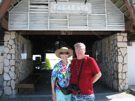
The ship departed through the north passage at 1700 hours.
PITCAIRN ISLAND
BACKGROUND:
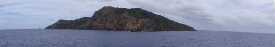
The Pitcairn Island is one of a group of four volcanic islands in the southern Pacific Ocean that form the last British Overseas Territory in the Pacific. The four islands – Pitcairn, Henderson, Ducie, and Oeno – are spread over several hundred miles of ocean and have a total land area of about 18 square miles. Only Pitcairn, the second largest island measuring about 2.2 miles from east to west, is inhabited.
The earliest known settlers of the Pitcairn Islands were Polynesians who appear to have lived on Pitcairn and Henderson, as well as nearby Mangareva Island 250 miles to the northwest, for several centuries. They traded goods and formed social ties between the three islands despite the long canoe voyages between them, helping the small populations on each island survive despite having very limited resources. Eventually important natural resources were used up, inter-island trade broke down and a period of civil war began on Mangareva, causing the small human populations on Henderson and Pitcairn to be cut off and eventually go extinct. Although archaeologists believe that Polynesians were living on Pitcairn as late as the 15th century, the islands were uninhabited when they were discovered by Europeans.
Pitcairn Island was sighted on 3 July 1767 by the crew of the British sloop HMS Swallow, commanded by Captain Philip Carteret. The island was named after Midshipman Robert Pitcairn, a fifteen-year-old crew member who was the first to sight the island. Robert Pitcairn was a son of British Marine officer John Pitcairn, who was killed in the American Revolution. Carteret, who sailed without the newly invented accurate marine chronometer, charted the island at 25° 2' south and 133° 21' west of Greenwich, but although the latitude was reasonably accurate, the longitude was incorrect by about 3°. This made Pitcairn difficult to find, as highlighted by the failure of Captain James Cook to locate the island in July 1773.
The islands are inhabited by the descendants of the Bounty mutineers and the Tahitians (or Polynesians) who accompanied them, an event retold in numerous books and films. This history is still apparent in the surnames of many of the islanders. With only about 54 inhabitants, originating from four main families, Pitcairn is the least populous national jurisdiction in the world.
The Mutiny on the Bounty was a mutiny aboard the British Royal Navy ship HMS Bounty on 28 April 1789. The mutiny was led by Fletcher Christian against their captain, Lieutenant William Bligh. According to accounts, the sailors were attracted to the "idyllic" life and sexual opportunities afforded on the Pacific island of Tahiti. It has also been argued that they were motivated by Bligh's allegedly harsh treatment of them. Eighteen mutineers set Bligh afloat in a small boat with eighteen of the twenty-two crew loyal to him. To avoid detection and prevent desertion, the mutineers then variously settled on Pitcairn Island or on Tahiti and burned Bounty off Pitcairn. In an extraordinary feat of seamanship, Bligh navigated the 23-foot open launch on a 47-day voyage to Timor in the Dutch East Indies, equipped with a quadrant and pocket watch and without charts or compass. He recorded the distance as 3,618 nautical miles. He then returned to Britain and reported the mutiny to the Admiralty on 15 March 1790, 2 years and 11 weeks after his original departure. The British government dispatched HMS Pandora to capture the mutineers, and Pandora reached Tahiti on 23 March 1791. Four of the men from Bounty came on board soon after her arrival, and ten more were arrested within a few weeks. These fourteen were imprisoned in a makeshift cell on Pandora's deck. Pandora ran aground on part of the Great Barrier Reef on 29 August 1791, with the loss of 31 of the crew and four of the prisoners. The surviving ten prisoners were eventually repatriated to England, tried in a naval court, with three hanged, four acquitted, and three pardoned. Descendants of some of the mutineers and Tahitians still live on Pitcairn. The mutiny has been commemorated in books, films, and songs.
Immediately after setting sixteen men ashore in Tahiti in September 1789, Fletcher Christian, eight other crewmen, six Tahitian men, and 18 women, one with a baby, set sail in the Bounty hoping to elude the Royal Navy. According to a journal kept by Edward Young, one of the mutineers, all but three of the Tahitian "women brought to Pitcairn had been kidnapped" when Christian set sail without warning them, the purpose being to kidnap the women. The mutineers passed through the Fiji and Cook Islands, but feared that they would be found there. Continuing their quest for a safe haven, on 15 January 1790, they rediscovered Pitcairn Island, which had been misplaced on the Royal Navy's charts. After the decision was made to settle on Pitcairn, livestock and other provisions were removed from Bounty. To prevent the ship's detection, and anyone's possible escape, the ship was burned on 23 January 1790 in what is now called Bounty Bay. Some of her remains, such as her ballast stones, are still partially visible in its waters. Her rudder is displayed in the Fiji Museum in Suva. An anchor of Bounty was recovered by Luis Marden in Bounty Bay in 1957.
The Pitcairn Island community began life with bright prospects. There was ample food, water, and land for everyone, and the climate was mild. Although many of the Polynesians were homesick, and the Britons knew they were marooned on Pitcairn forever, they settled into life on Pitcairn fairly quickly. A number of children were born. At the time the community on Pitcairn was first visited by outsiders, John Adams "was the sole surviving mutineer". Little is agreed upon regarding Fletcher Christian's role once the mutineers were established on Pitcairn Island. Adams claimed "Christian 'was always cheerful'" but also claimed Christian would: "...retreat and brood [in a cave, and] had 'by many acts of cruelty and inhumanity, brought on himself the hatred and detestation of his companions.'" Adams variously claimed that Christian had been killed "in a single massacre that occurred on the island about four years after arrival" and that Christian had "committed suicide". Adams at another point claimed the "mutineers had divided into parties, 'seeking every opportunity on both sides to put each other to death.'" While the details were inconsistent, Adams usually agreed with the journal of Young: that Christian died as the result of a massacre: "The massacre had taken place in several waves of violence, and principally arose from the fact that the Englishmen had come to regard their Tahitian friends as slaves." The women, "passed around from one 'husband' to the other, as men died and the balance of power shifted", eventually "rebelled" as well.
In 1793, a conflict broke out on Pitcairn Island between the mutineers and the Tahitian men who sailed with them. Fletcher Christian and four of the mutineers (Jack Williams, Isaac Martin, John Mills, and William Brown) were killed by the Tahitians. All six of the Tahitian men were killed during the on-and-off fighting, some by the widows of the murdered mutineers and others by each other. Fletcher Christian was survived by Maimiti and their son Thursday October Christian (sometimes called "Friday October Christian"). Rumors persisted that Christian left the island and made it back to England. There are other reports that Christian actually committed suicide. Of the Tahitian women, early on, one died in a fall while gathering eggs from a cliff and another from a respiratory illness (thus precipitating the taking of the Tahitian men's consorts). Christian's death caused a leadership vacuum on the island. Two of the four surviving mutineers, Ned Young and John Adams (also known as Alexander Smith), assumed leadership, and some peace followed, until William McCoy created a still and began brewing an alcoholic beverage from a native plant. The mutineers began drinking excessively and making life miserable for the women. The women revolted a number of times—with the men continually "granting pardons" (each time threatening to execute the leaders of the next revolt)—and some of the women attempted to leave the island on a makeshift raft; it swamped in the "bay". Life in Pitcairn continued thus until the deaths of McCoy and Quintal, and the destruction of the still.
William McCoy died after a drunken fall. Matthew Quintal was subsequently killed by John Adams and Ned Young after threatening to kill everyone. Eventually John Adams and Ned Young were reconciled with the women, and the community began to flourish. Ned Young succumbed in 1800 to asthma, the first man to die of natural causes. After Young's death in 1800, Adams became the leader of the community, and took responsibility for educating its members. Adams started holding regular Sunday services and teaching the Christian religion to the settlement. His gentleness and tolerance enabled the small community to thrive, and peace was restored to Pitcairn Island, with the population measuring one man, nine Tahitian women and dozens of children.
OUR VISIT:
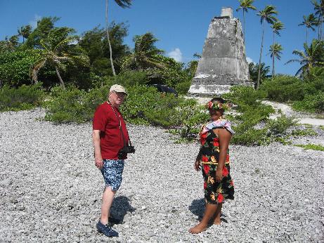
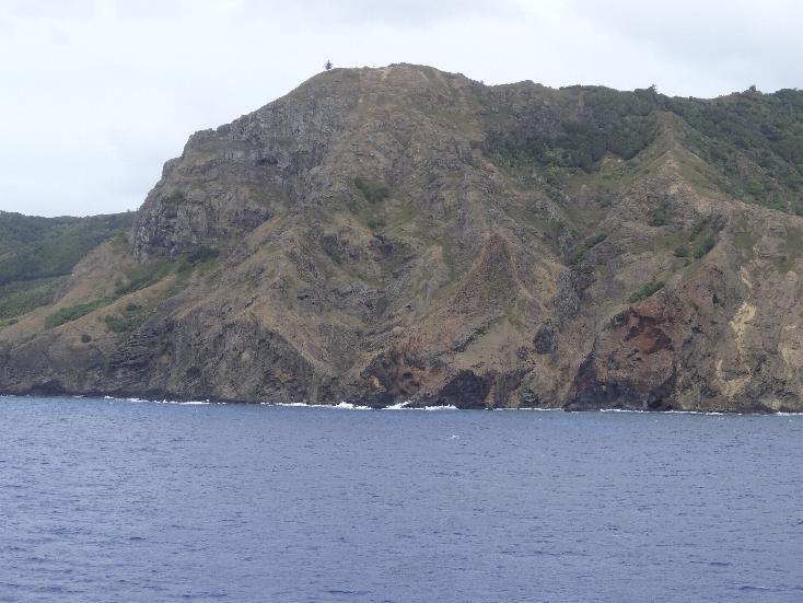
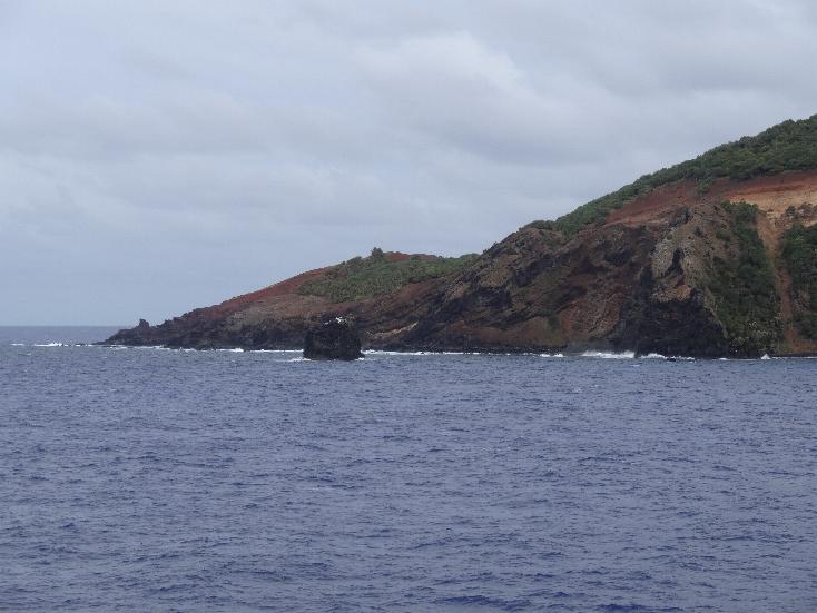
We arrived at about 0800 and anchored out. The Captain announced that there would be no tenders today because of the weather. The local folks would come out to the ship to set up a craft store to sell locally produced items and the post office would set up a station on the ship.
We were angered by the decision to cancel shore parties.
The island is lush though very mountainous with steep palisades at most of the shoreline. They grow a lot of food but much has to be imported.
Later we attended a presentation on Pitcairn by Jacqui Christian, a seventh generation descendent of Fletcher Christian. She gave an excellent presentation and corrected some of the errors in the Marlon Brando version of "Mutiny on the Bounty."
In the movie, the ship was deliberately set ablaze by some mutineers to prevent Christian from sailing back to England to present their side of the mutiny to the Admiralty. In reality , it was probably an accident when one of the crew members knocked over a lantern while stripping the ship. Another in the movie Christian dies after being burned on the ship trying to rescue a sextant and other items. In reality, The Tahitian men were upset because they had to share women while the crewmembers each had their own. One day the Tahitians asked Christian to loan them muskets to hunt pigs. The "pigs" turned out to be the European crewmen. They shot and killed five including Christian.
Three others were not found so they survived. The Tahitian women later killed the Tahitian men.
The last crew survivor was John Adams who along the women and children were discovered by a passing American ship. They were left to live in peace.
She was asked how many ships actually visit the town. She replied that this year 14 cruise ships had stopped but only 80 passengers off of one ship made it ashore. She said the EU was sponsoring the construction of a new landing at Tedside that should enable 40% of passengers to actually visit the island and Adamstown.
Most of the population is Seventh Day Adventist and that is the only church on the island. She said the Bounty mutineers were all Church of England as were the women. Seventh Day Adventist missionaries visited the island n the late 1800s and converted the people.
The have a grammar school but the children are sent to New Zealand for high school and college. Most never return.
She made a pitch for new immigrants. To qualify, you have to live on the island for two years and then you are granted residency. Land is free for residents but building a house will cost about NZ$110,000. They have most conveniences including electricity and internet that they have to pay for. Most all people including the aged work but tourism is now the main source of income. Postage stamps used to be their major revenue source but that is changing now as there are fewer collectors.
She said there is a supply ship that calls every three months. They bring food and other goods so you only have to shop once each quarter. The ship also carries up to twelve passengers to Pitcairn but the cost is "exorbitant."
Jacqui's father was Tom Christian, a long time radio ham VR6TC who I have had the pleasure of contacting several times over the years. Tom died a year ago. Jacqui said she is licensed as VP6PI but has not been on the air.
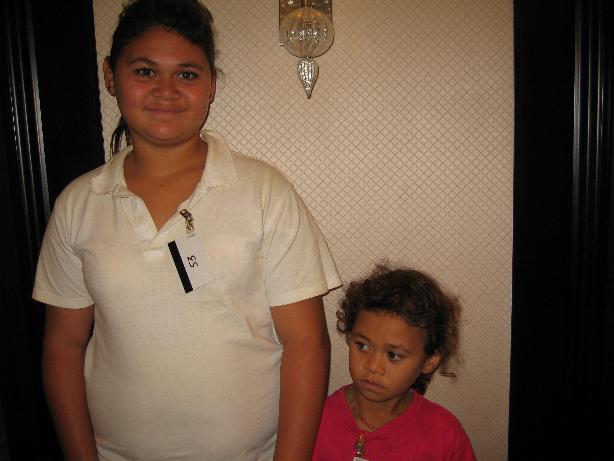
Two island girl visitors
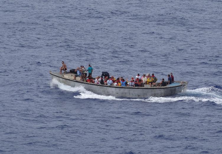
Islanders heading home after ship visit
RAPA NUI - EASTER ISLAND
BACKGROUND:
Easter Island (Rapa Nui: Rapa Nui, Spanish: Isla de Pascua) is a Polynesian island in the southeastern Pacific Ocean, at the southeasternmost point of the Polynesian Triangle. Easter Island is famous for its 887 extant monumental statues, called moai, created by the early Rapa Nui people. The name "Easter Island" was given by the island's first recorded European visitor, the Dutch explorer Jacob Roggeveen, who encountered it on Easter Sunday (5 April) 1722, while searching for Davis or David's island. Roggeveen named it Paasch-Eyland (18th century Dutch for "Easter Island"). The island's official Spanish name, Isla de Pascua, also means "Easter Island".
Polynesian people settled on Easter Island in the first millennium AD, and created a thriving culture, as evidenced by the moai and other artifacts. The island was most likely populated by Polynesians who navigated in canoes or catamarans from the Gambier Islands (Mangareva, 1,600 miles away) or the Marquesas Islands, 2,000 miles away. When James Cook visited the island, one of his crew members, a Polynesian from Bora Bora, was able to communicate with the Rapa Nui. The language most similar to Rapa Nui is Mangarevan with an 80% similarity in vocabulary.
Human activity, the introduction of the Polynesian rat and overpopulation led to gradual deforestation and extinction of natural resources, which caused the demise of the Rapa Nui civilization. By the time of European arrival in 1722, the island's population had dropped to 2,000–3,000 from a high of approximately 15,000 just a century earlier. Diseases carried by European sailors and Peruvian slave raiding of the 1860s further reduced the Rapa Nui population, down to 111 in 1877.
Easter Island is one of the most remote inhabited islands in the world. The nearest inhabited land (50 residents) is Pitcairn Island 2,075 kilometres (1,289 mi) away, and the nearest continental point lies in central Chile, 2,182 miles away.
Easter Island is a special territory of Chile that was annexed in 1888. It has about 5,800 residents, of which some 60% are descendants of the aboriginal Rapa Nui.
OUR VISIT:
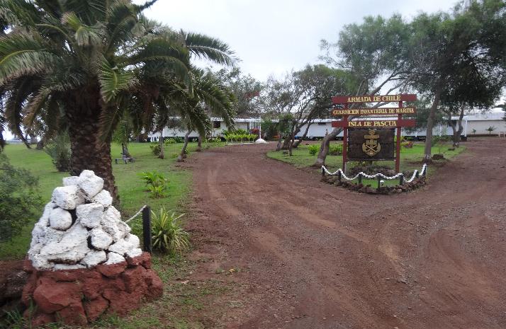
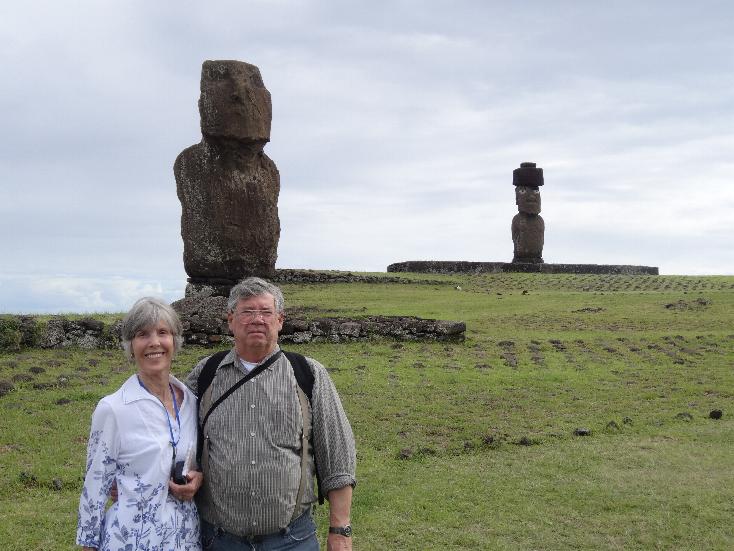
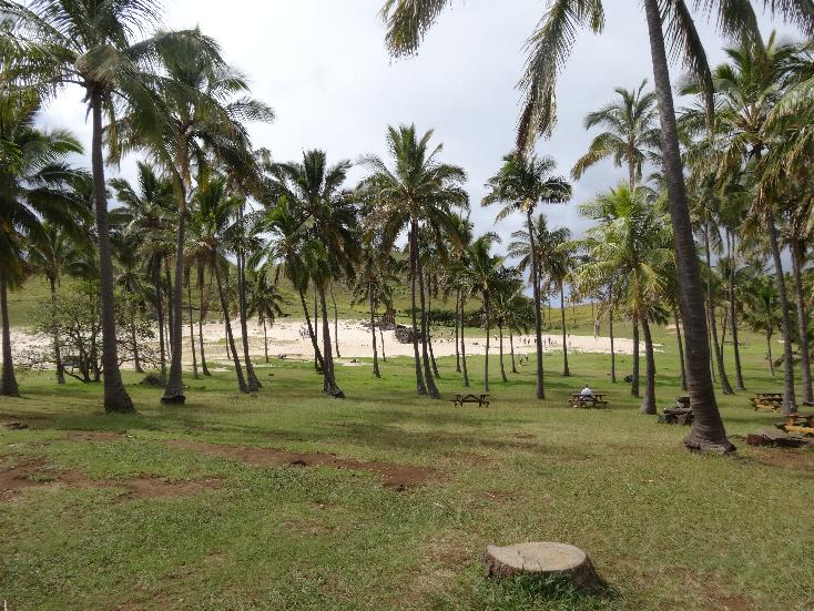
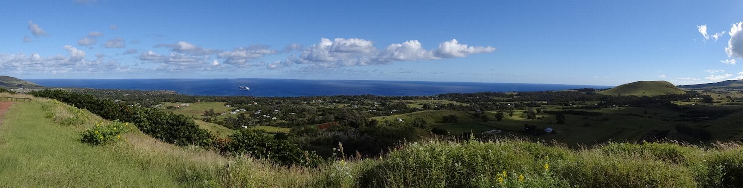
We arrived at Hanga Roa on our final island, Rapa Nui or Isla de Pascua or
Easter Island, at 0800 hours and anchored out aways. We had signed up for a
tour given by a Brit expatriate on the island, James Grant-Peterkin, who wrote
the definitive book on the island, A COMPANION TO EASTER ISLAND.
The ship also offered similar tours but they charge 2 to 3 times what the
operators charge. Many of the passengers had signed up for the various
tours offered by the ship. We had to wait until they all disembarked before te
ship let we (known as "independents") could board a tender to
shore. We were supposed to start our tour at 0830 but did not get ashore until a litle after 1100. The island has a single spot on the quay where cruise
ship tenders can land so only one tender at a time could drop passengers
off, really slowing the process. The harbor is sprinkled with many off shore
rocks and shoals so tenders can only operate during daylight tours.
We joined a group of 18 people on a small tour bus. Our guide the first day was
Carlos, who was born there and lived there most of his life. He had lived
in Redondo Beach CA for a time where he learned English. I used to talk to a
fellow ham radio operator down there in the 1970s, Father Dave, a Catholic
priest, who had the call CE0AA. I asked Carlos if he knew
him and he did and said he was a close friend with Father Dave and had served as
an altar boy for him!
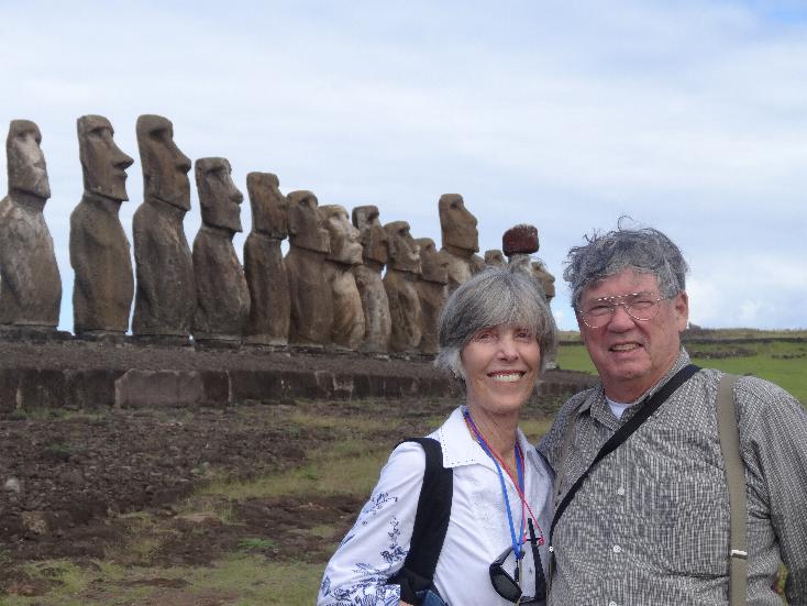
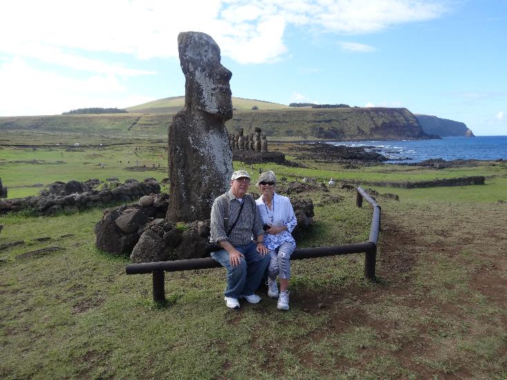
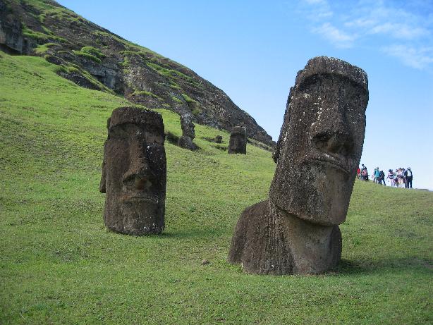
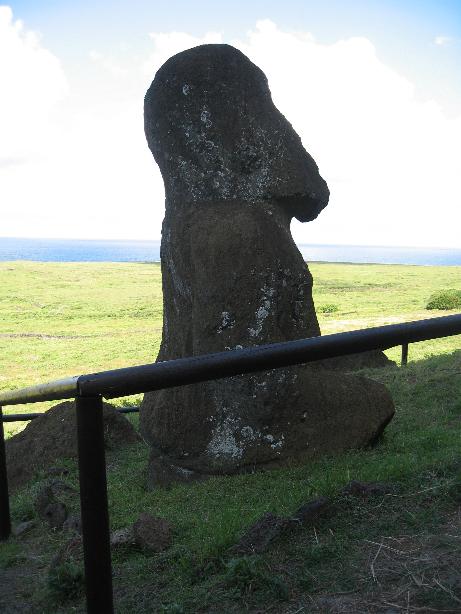
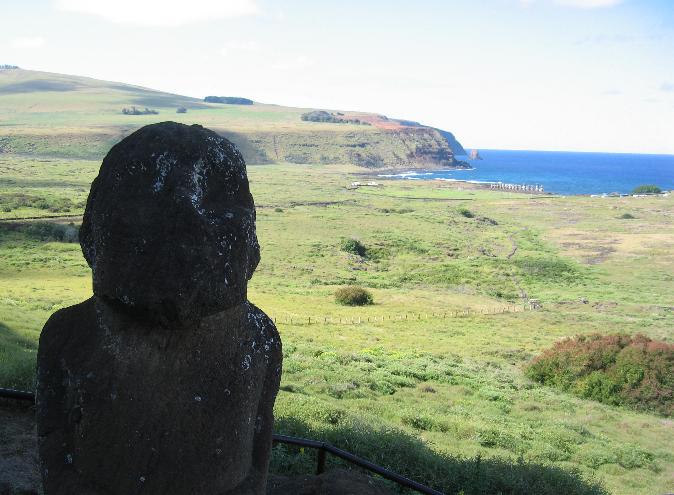
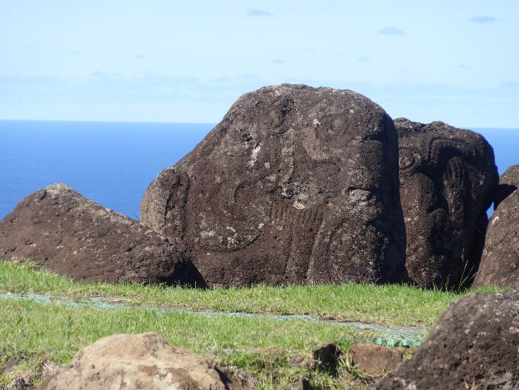
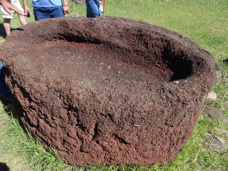
Our first stop was Tahai where we saw our first of many many moai (the statues).
One had the eyes installed. Archeologists had found an eye in the area. It
was made of coral so these eyes were modern reproductions. Carlos told us that
the eyes were installed after the moai was erected on the ahu (a large
platform that was sacred to the original Polynesian
inhabitants). The moai were carved at a quarry on the otherside of the island
and transported to the various sites by unknown means. The moai came in
various sizes, most of them about 6 meters high (about 20 feet). The largest was
20 meters (about 65 feet) but it was never moved from the quarry. The moai
were raised by a group of probably a dozen men who use
two logs to start the raising then put rocks in the air space under the statue.
Then they raised it again and put more rocks to hold the attitude. It
supposedly took about a week to raise each one.
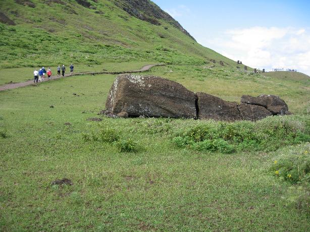
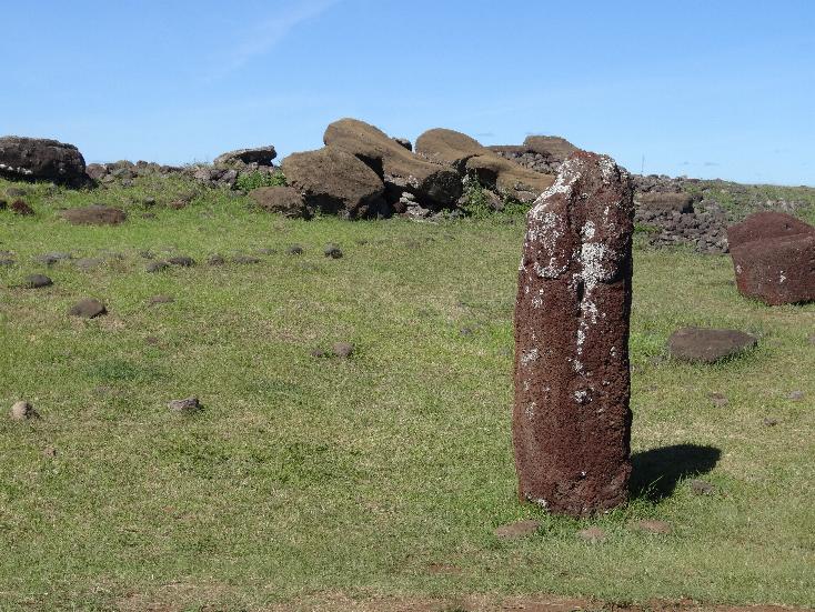
Almost all of the moai were toppled and lay on the ground, usually face down, by
the time the late 18th Century Europeans arrived. Archeologists spurred on by the famous
Norwegian explorer/author Thor Heyerdahl, raised the moai back to an upright position.
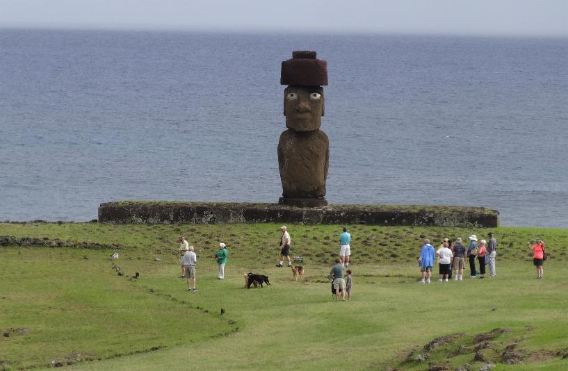
Chilean Navy Marine Infantry Base --- Moai at Tahai with restored eyes
Tahai
Tahai Moai (one at far right in right photo has topknot)
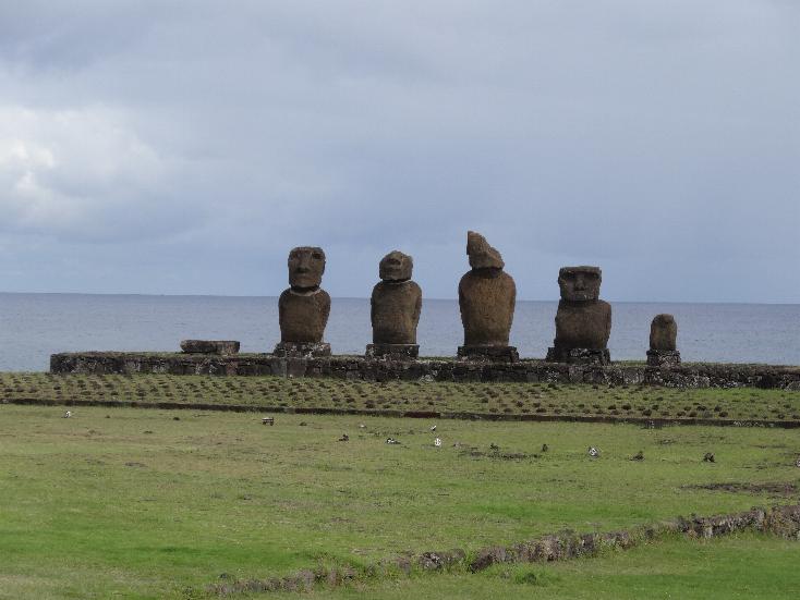
Our next stop was Anakena, another site quite close to a sandy beach. There is
an ahu with a group of seven moai, four of which have the red topknots on
them. There is another, Ahu Ature Huki, that was just reinstalled on its own ahu
in 2013.
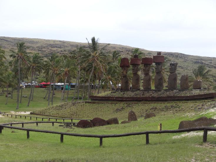
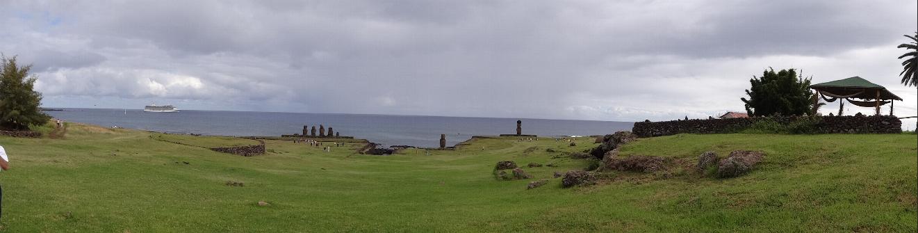
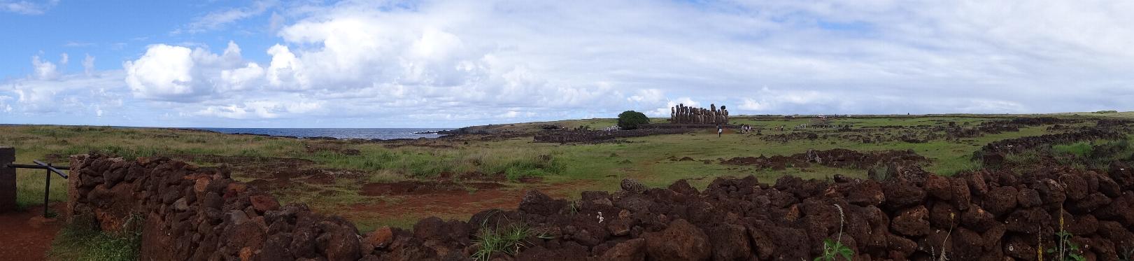
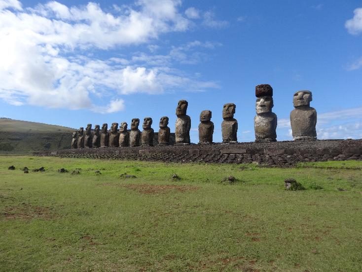
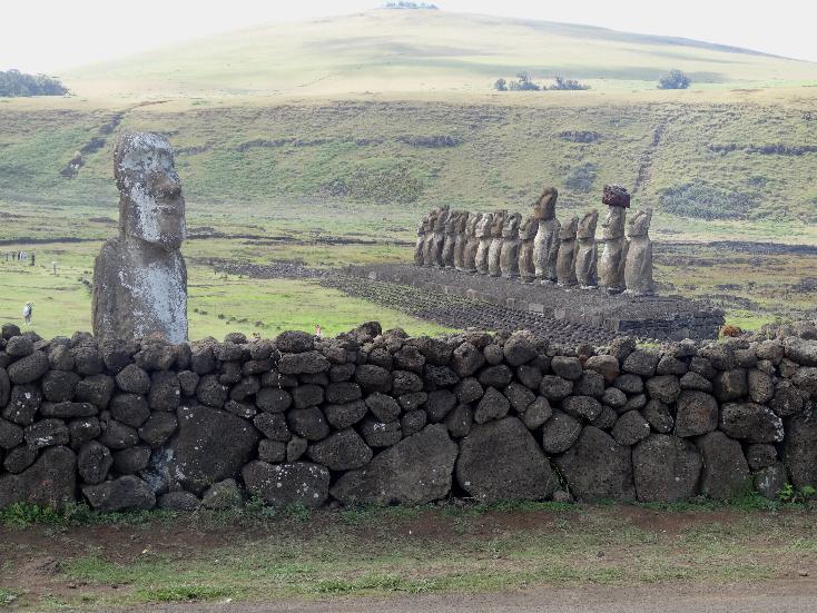
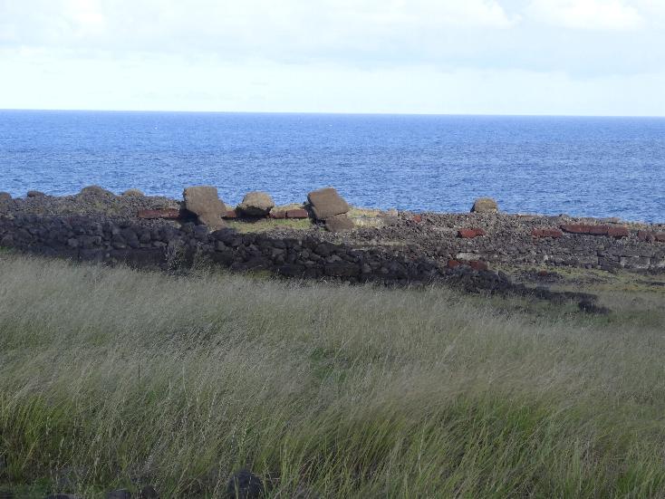
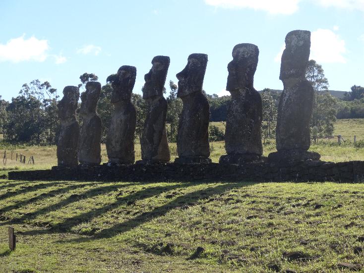
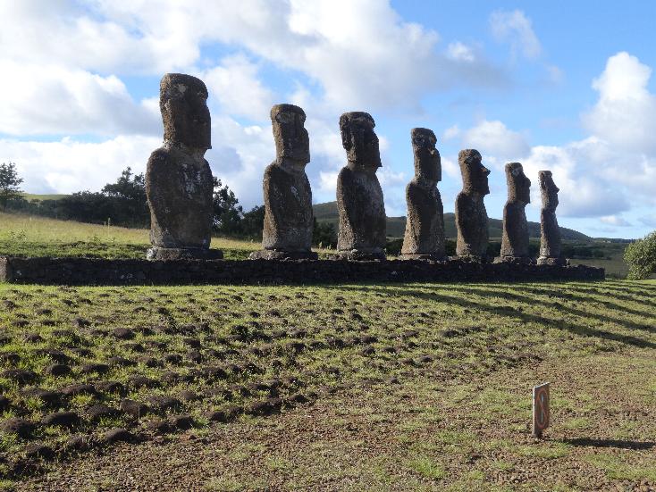
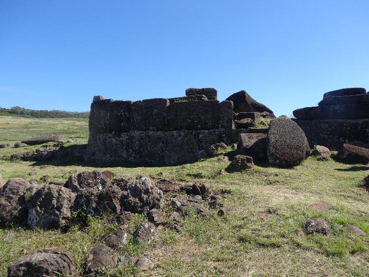
Our next stop was Ahu Tongariki. This site has a large multi-layered atu with
fifteen moai standing. There is also a single moai off by itself.
Next we visited Rano Raraku where there is one of the volcanos and where the
quarry that was the site of carving and distribution of the moai is
located. There are two trails, one of to the caldera of the volcano and the
other to the quarry. We wanted to see the quarry with its uncompleted moai
and other relics of that age. The trail runs for 1.5 km. (about 1 mile) up
the side of the mountain and back down. We passed many finished moai, several
fallen and broken ones, the unfinished 20 meter largest moai, the spot
where three partially carved moai are still in the quarry, and the only kneeling
moai.
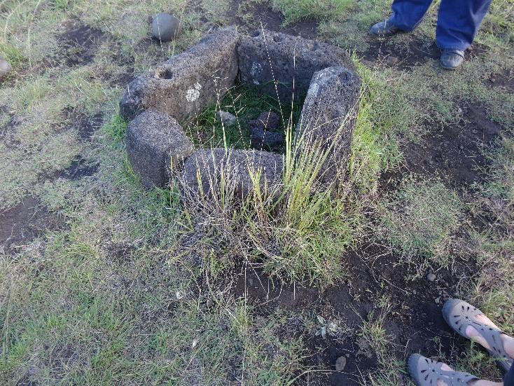
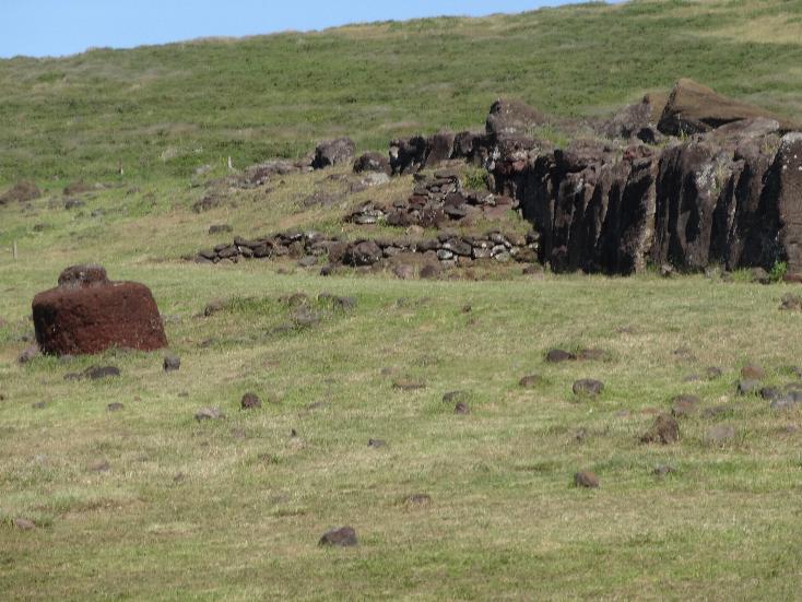
On the way back to the port we stopped at Akahanga which is an unrestored
archeological location. There were stone foundations of the houses, a fire
pit, and the remains of an ahu and a few moai. The houses when erected resembled
an upside down boat that were held up by poles that were inserted into
holes in the foundation stones. There was a group of borses grazing at the site.
At the landing, there were several tables set up by locals selling souveniers. I
was even able to buy a cold can of Escudo Cerveza from Santiago (there is
no brewery on the island).
The next morning we went through the same game, ship's tour participants all
went ashore first and then we independents got to go. We did land a little
after 0930 so we had not lost as much time as we did the previous day.
This time we were assigned to a different group with a different guide,
Christian. We resumed the tour, first visiting Ahu Akivi. There was a large
ahu with seven standing moai. Someone had also reconstructed one of the ancient
houses (mounted on a boat trailer).
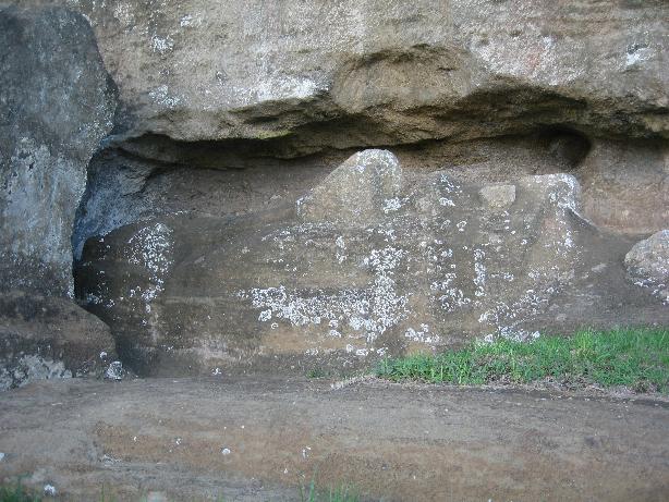
Next we rode to Puna Pau, a volcano crater where the red stones were quarried
the make the pukaos (the moai' topknots). There are about twenty pukaos as
the site, some with faded petroglyphs of boats and clan symbols (the National
Park people no longer allow people to touch the relics and there are very
stiff fines if you are caught doing it).
Looking towards Hanga Roa
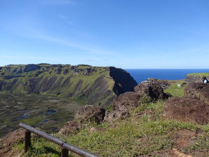
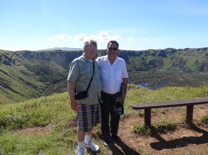
After Puna Pau we headed to Orongo, a site that features one of the volcanos. We
came upon an area where the National Park people reconstructed cave houses
of the types that the Polynesians would hide in during difficult times (wars,
etc.). Near them are some stones emblazened with petrogylphs. The caldera
of the volcano is at this same site. It is a very large
crater with a break on the side to the sea. The bottom has
a few feet of water and natural pads which Christian assured us you can
walk on. We had a beautiful view of the southern part of the island including
Hanga Roa. I took a few panorama pictures that span from the ocean on the
lee side to the ocean on the windward side of the island . We ran into Carlos
our guida from yesterday who served with Fr. Dave CE0AA. It was a very beautiful site to view from to top of the volcano.
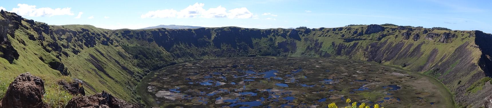
The caldera
Our last stop before heading back was at Vinapu, another site with toppled moai
and an unreconstructed ahu. There is the only female representation on moai. You
can make out a breast and a navel. Capt. Cook visited the island in 1774 and an
illustrator on his crew drew a picture of it with location and that's how we
know it today. There was also an area with an altar-like
structure that they believe was used for human sacrifices.
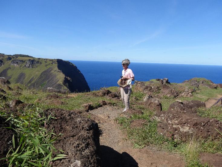
The scenery of the island is quite beautiful. There are at least four inactive
volcanos on the island. The landscape and seashore are strewn with lava
rocks and outcroppings. The island used to be heavily forested but today is
sparsely so. Most of the larger trees are eucalyptus imported in recent
years. The are a couple of pretty flowers growing wild, little yellow Lupinas, almost like a snap dragon, growing in brush. The other is a
pretty orange-red one called Lions Claws that grow on small trees. The
shoreline is quite rugged and the waves crash beautifully upon the rocks. Many
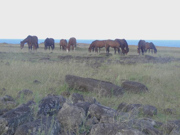
areas are tilled by locals for produce but most of the island is green
blanketed by grasses. The locals raise livestock, cattle for food and horses for riding. The stock roam all over the island even crossing roads at
their leisure. The main town is Hanga Roa but it is pretty spread out.
There are many hotels as tourism is the economic engine that sustains the
locals. Prices are very reasonable here, unlike French Polynesia.
Rapa Nui was a most interesting place to visit. Marilyn said she could live here
if things continue to worsen in the USA.
LIMA PERU
BACKGROUND:
In the pre-Columbian era, the location of what is now the city of Lima was inhabited by several Amerindian groups under the Ychsma polity, which was incorporated into the Inca Empire in the 15th century. In 1532, a group of Spanish conquistadors led by Francisco Pizarro defeated the Inca ruler Atahualpa and took over his Empire. As the Spanish Crown had named Pizarro governor of the lands he conquered, he chose the Rímac valley to found his capital on 18 January 1535 as Ciudad de los Reyes (City of the Kings). In August 1536, rebel Inca troops led by Manco Inca besieged the city but were defeated by the Spaniards and their native allies.
Lima gained prestige after being designated capital of the Viceroyalty of Peru and site of a Real Audiencia in 1543. During the next century it flourished as the center of an extensive trade network which integrated the Viceroyalty with the rest of the Americas, Europe and the Far East. However, the city was not free from dangers; the presence of pirates and privateers in the Pacific Ocean lead to the building of the Walls of Lima between 1684 and 1687.
Balconies were a major feature of Lima's architecture during the colonial period. In 1746, a powerful earthquake severely damaged Lima and destroyed Callao, forcing a massive rebuilding effort under Viceroy José Antonio Manso de Velasco. In the later half of the 18th century, Enlightenment ideas on public health and social control shaped the development of the city. During this period, Lima was adversely affected by the Bourbon Reforms as it lost its monopoly on overseas trade and its control over the important mining region of Upper Peru. The city's economic decline made its elite dependent on royal and ecclesiastical appointment and thus, reluctant to advocate independence.
A combined expedition of Argentine and Chilean patriots under General José de San Martín landed south of Lima in 1820 but did not attack the city. Faced with a naval blockade and the action of guerrillas on land, Viceroy José de la Serna e Hinojosa evacuated its capital on July 1821 to save the Royalist army. Fearing a popular uprising and lacking any means to impose order, the city council invited San Martín to enter Lima and signed a Declaration of Independence at his request. However, the war was not over; in the next two years the city changed hands several times.
During the 1879–1883 War of the Pacific, Chilean troops occupied Lima, looting public museums, libraries and educational institutions. At the same time, angry mobs attacked wealthy citizens and the Asian population; sacking their properties and businesses. After the war, the city underwent a process of renewal and expansion from the 1890s up to the 1920s. During this period, the urban layout was modified by the construction of big avenues that crisscrossed the city and connected it with neighboring towns.
Today with about 9 million inhabitants, about one-third of the Peruvian population lives in the metropolitan area. The area is almost pertetually coved by clous though very little rain falls.
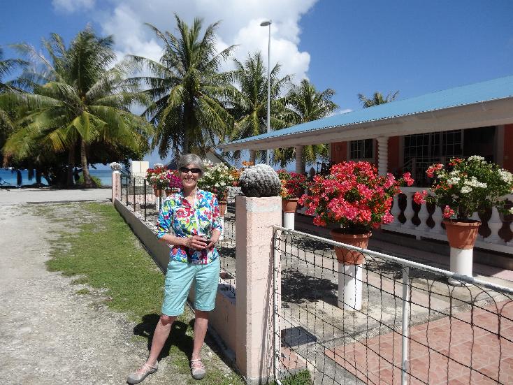
OUR VISIT:
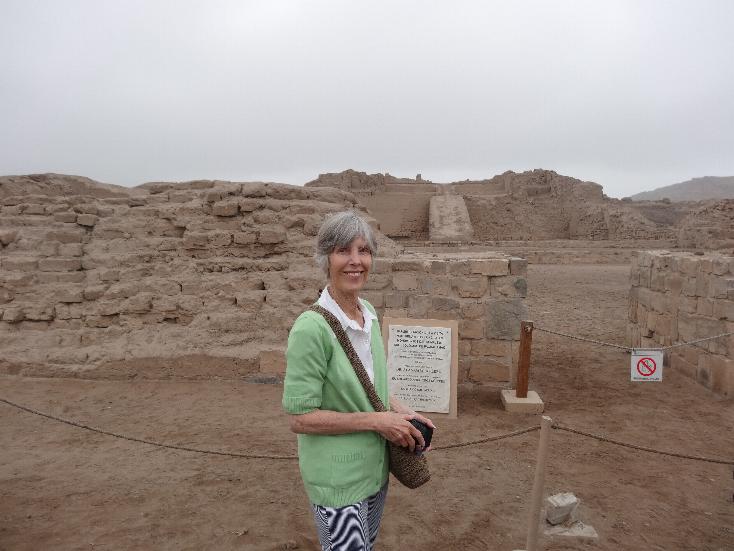
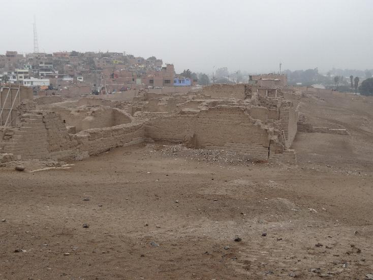
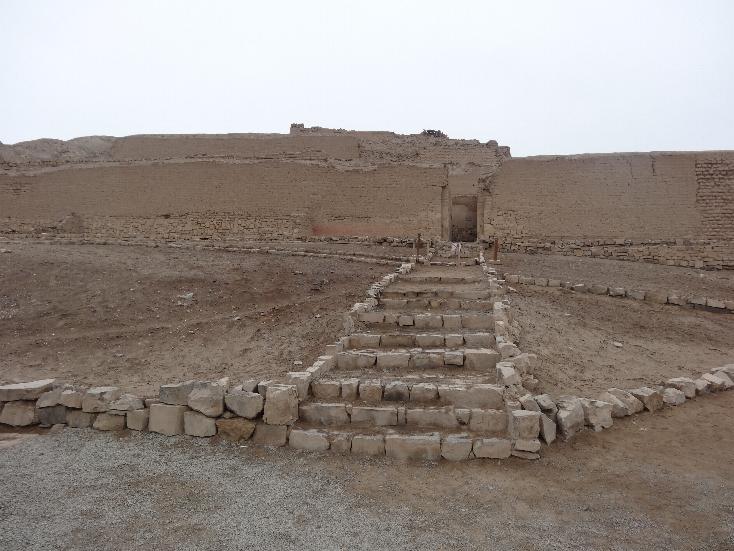
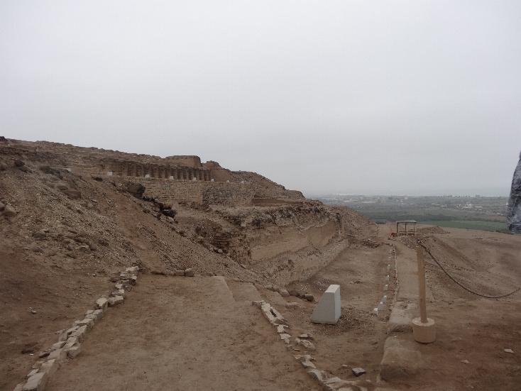
We arrived in Callao and disembaked there. We joined an independent tour given by Peru Inca Wonders. There were two guides, a lady and a gent named Enrique. We traveled to Lima, stopping at an archeological site, Pachacamac. Most of the common buildings and temples were built c. 800-1450 AD, shortly before the arrival and conquest by the Inca Empire.
Archaeologists have identified at least 17 pyramids (many of them irreversibly damaged by the El Niño weather phenomenon). Besides pyramids, the site had a cemetery and multicolored fresco of fish from the Early Intermediate period (c. 200-600 AD). Later, the Huari (c. 600-800 AD) constructed the city, probably using it as an administrative center. A number of Huari-influenced designs appear on the structures and on the ceramics and textiles found in the cemeteries of this period. After the collapse of the Huari empire, Pachacamac continued to grow as a religious center. The majority of the common architecture and temples were built during this stage (c. 800-1450 AD).
By the time the Tawantinsuyu (Inca Confederacy) invaded the area, the valleys of the Rímac and Lurín had a small state which the people called Ichma. They used Pachacamac primarily as a religious site for the veneration of the Pacha Kamaq, the creator god. The Ichma joined the Incan Empire, which used Pachacamac as an important administrative center. The Inca maintained it as a religious shrine and allowed the Pachacamac priests to continue functioning independently of the Inca priesthood. This included the oracle, whom the Inca presumably consulted. The Inca built five additional buildings, including a temple to the sun on the main square.
Excavations are ongoing. There were a number of workers manually digging and carting earth by wheelbarrows. It is quite an extensive site but as most of the structures were built with adobe, it is difficult to envision the original grandeur with the soil being the same color.
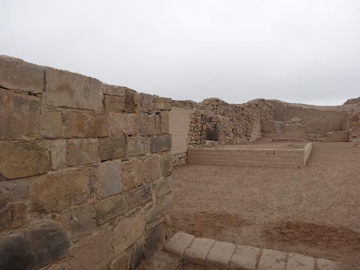
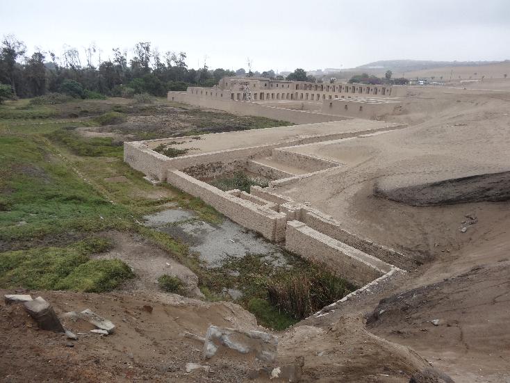
The last two shots are the Temple of the Sun (left) and being-reconstructed Temple of the Moon (right).
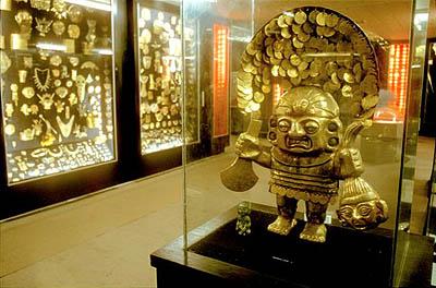
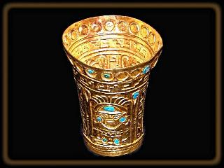
After that we went to the Gold Museum in Lima's suburbs. The museum on the first floor featured weaponry fro0m ancient to modern times. The basement houses a collection of pre-Colonial and a few Colonial period works in gold, silver, and textiles. The Spaniards melted most of the gold and silover artifacts that they encountered. Thye Incas valued gold only as a decorative and would trade gold for seashells. Some of the material was discovered after the Colonial period and are presaerved in this museum. I underestand many of the items on display are modern-made replicas but seeing all that gold was awesome. The museum does not allow any photography so I can't display the exhibits. Here is a couple of shots someone took and posted on the iinternet:
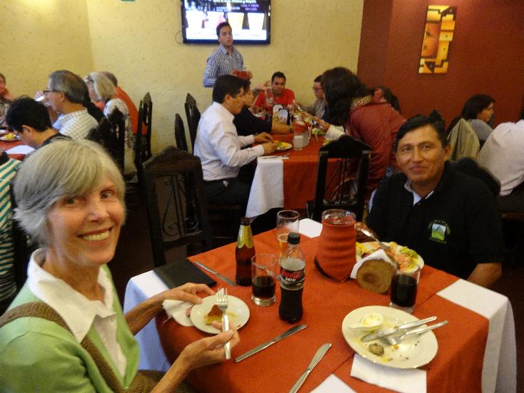
Next we stopped for a buffet lunch at Aroma's Peruanos, a popular restaurant in Lima.
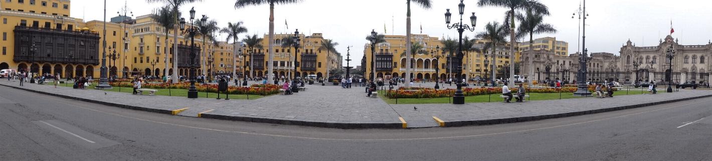
Then we went through Lima to Plaza Mayor (actually Plaza de Armas). This is the main square of Lima and where the center of the government is. Here is a panorama shot taken from the Cathedral steps. Thw building to the far left is the Muncippal Palace and the one to the far right is the National Palace.
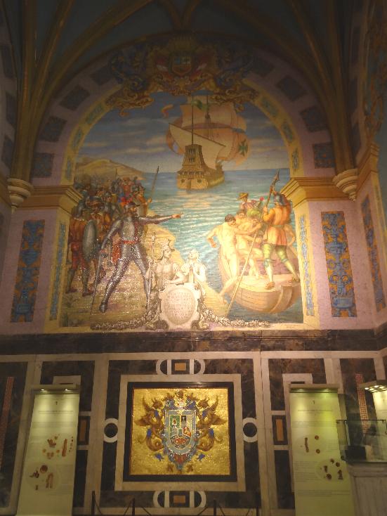
On the day of the foundation of the city, 18 January 1535, the conquistador Francisco Pizarro, conforming to established procedure, designated a location to build the plaza. Later, Pizarro and Nicolas de Rivera, the city's first mayor, toured the city's location and split parcels. Pizarro, taking advantage of his title of founder and governor, took a large parcel of land between the north side of the plaza and the Rimac river. The lot to the south of the plaza was designated to be a church, the western lot was to be the site of a city council, and the rest of the lots were divided among the rest of the conquistadors. The Cathedral of Lima was completed in 1622. This church still stands today on the plaza. The tomb of Francisco Pizarro is located within the church.
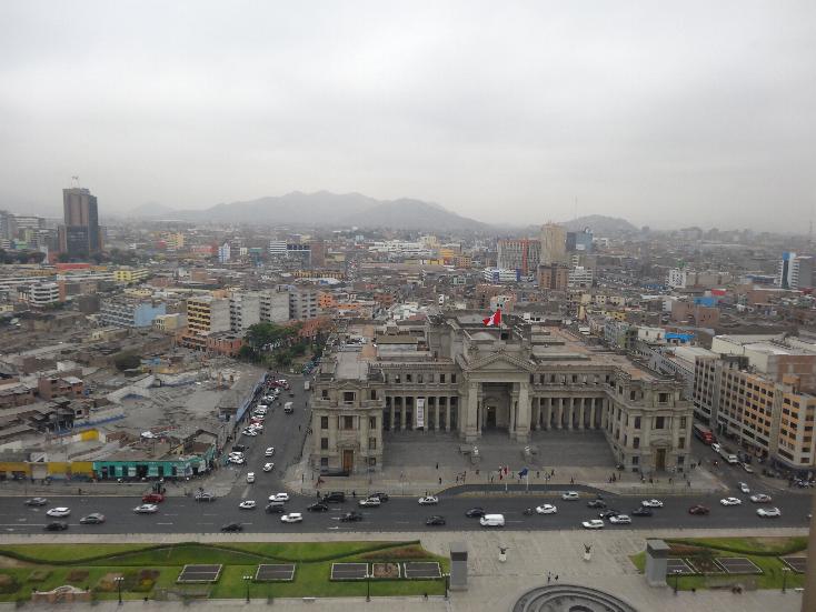
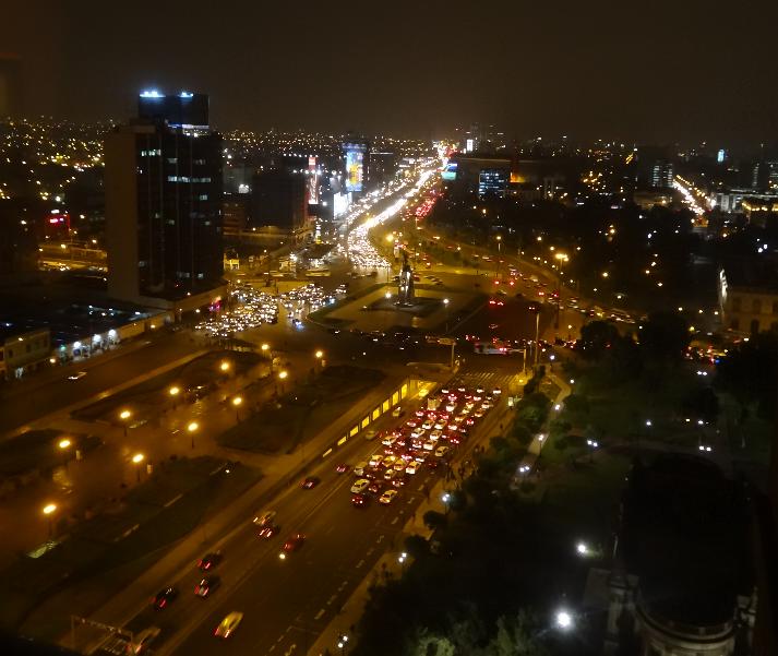
We were then dropped off at our hotel, the Sheraton across the street from the Palace of Justice (the Supreme Court). We were on the 19th floor and this is what we saw when we looked out our windows.
That night, being tired, we ate in the hotel's restaurant. Marilyn had a filet Peruvian style and I had a grilled filet. The waiter spoke poor English. I ordered it medium rare. He said "medium?" I told him no, medium rare (emme ere (MR letters in Spanish)). The steak came and I cut it. It was well done. I then said "rojo" (red). That worked and I got a rare steak finally!
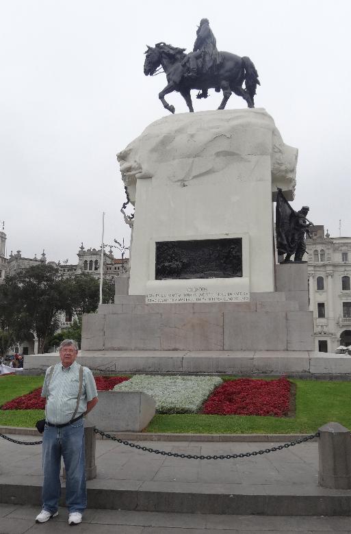
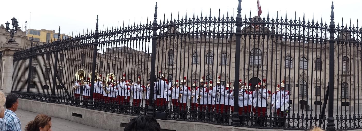
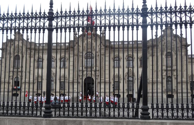
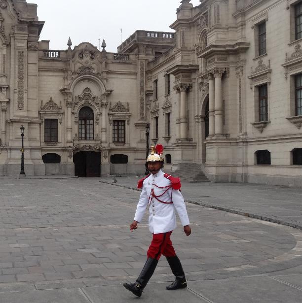
The next morning we walked up to Plaza San Martin then to Plaza Mayor to see the changing of the guard at the National Palace.
We stopped at San Martin and took a few photos. San Martin was an Argentine who is entitled with Bernardo O'Higgins of Chile, as the Liberators in the war for independence.
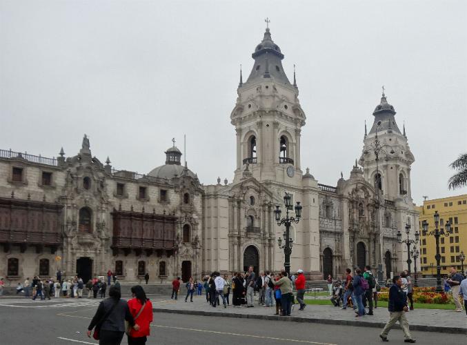
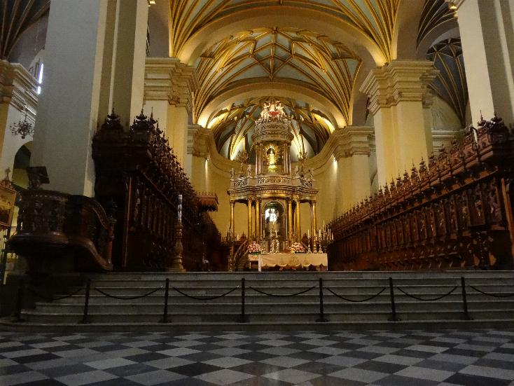
We next visited the Cathedral on Plaza Mayor, a very impressive structure.
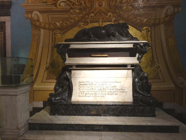
Tomb of Pizarro
The changing of the guard occurs at 12 Noon every day. It is preceded by the military band playing popular Latin tunes from 1130 unto 1200. At 1200, troops march from both side buildings to the center slowly goosestepping to the martial music by the band. It is quite impressive. I made a video of it that I will post on youtube.
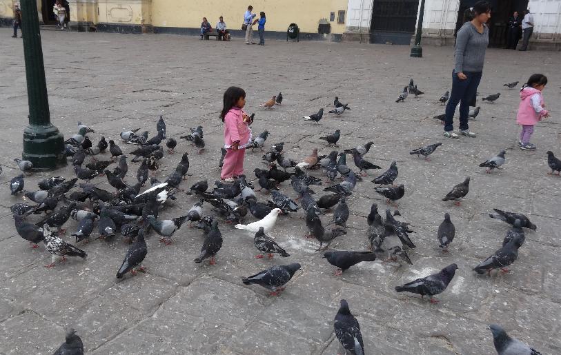
We then walked down to the Basilica y Convento San Francisco. The church and monastery were consecrated in 1673 and completed in 1774. Though it survived several earthquakes intact in 1687 and 1746, it suffered extensive damage in an earthquake in 1970. The police close of the Plaza for the ceremony and three are behind Marilyn after the close. Thye two cute little Indian girls were throwing bread to the pigeons outside the church.
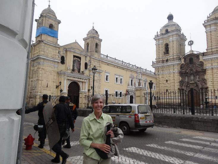
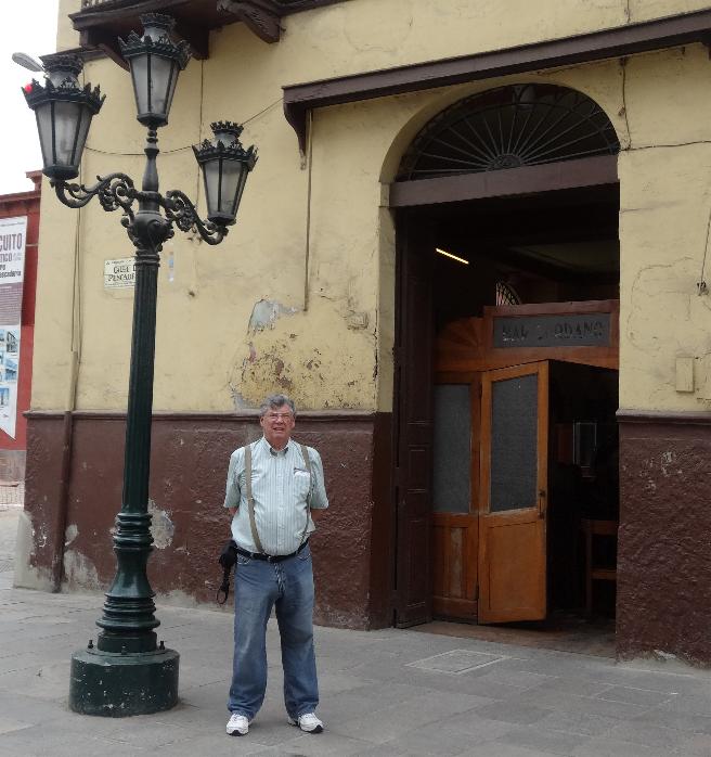
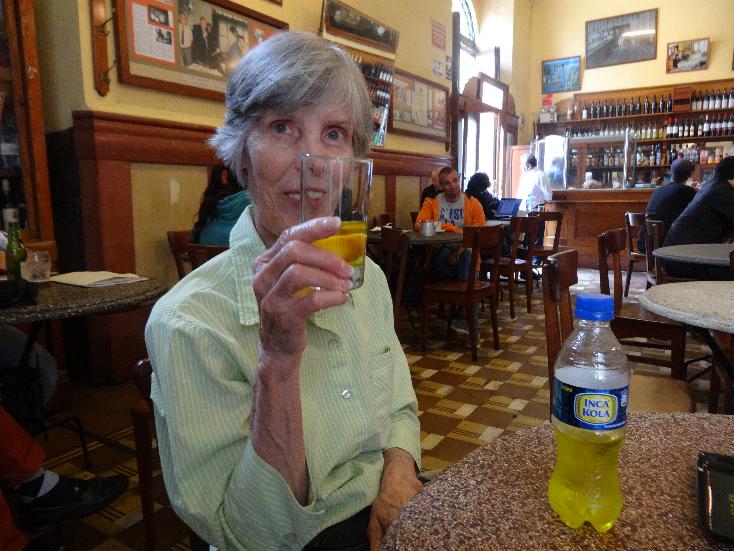
The guide the day before told us that a nearby bar, Bar Cordero, is the oldest inb Lima. Turns out it onloy dates to 1905 but we stopped for a Cusqueña cerveza and an Inca Cola.
We then headed back to the Cathedral and it's art annex. Then we walked back on Jirón de la Unión to the hotel. The street was much busier than it had been earlier in the day. We ended up having some Popeye's Louisiana Kitchen fried chicken at the Plaza Real, a shopping mall adjacent to our hotel.
We retired early as we had a wakeup call for 0330 inorder to take a taxi to the airport for our 0700 departure to Miami.
Lima and its environs are a nice place to visit. The major area, near Plaza Mayor, and Miraflores are safe. There are armed police and soldiers throughout the area to keep it secure. We saw small towns coming from Callao, most were fine but some of the houses on the outskirts were definitely third world.